You are here: Home > Network List > CN - Canadian National Seismograph Network Stations List
> Station INK INUVIK, NT > Earthquake Result Viewer
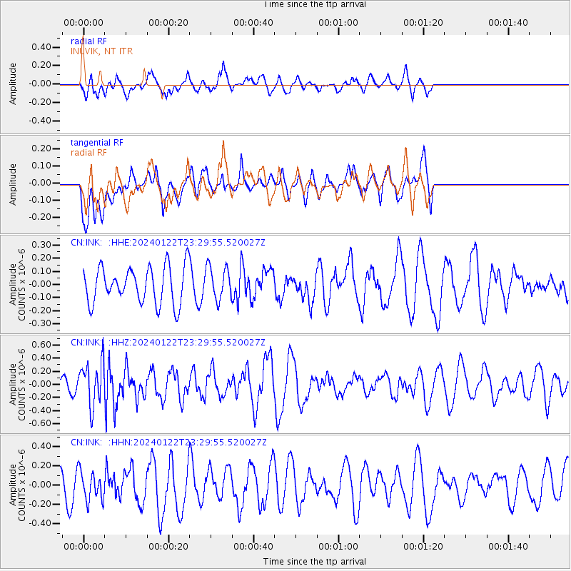
INK INUVIK, NT - Earthquake Result Viewer
*The percent match for this event was below the threshold and hence no stack was calculated.
| Earthquake location: |
Kyrgyzstan-Xinjiang Border Reg. |
| Earthquake latitude/longitude: |
41.2/78.7 |
| Earthquake time(UTC): |
2024/01/22 (022) 23:19:26 GMT |
| Earthquake Depth: |
10 km |
| Earthquake Magnitude: |
5.6 mb |
| Earthquake Catalog/Contributor: |
NEIC PDE/us |
|
| Network: |
CN Canadian National Seismograph Network |
| Station: |
INK INUVIK, NT |
| Lat/Lon: |
68.31 N/133.53 W |
| Elevation: |
44 m |
|
| Distance: |
68.2 deg |
| Az: |
12.342 deg |
| Baz: |
334.297 deg |
| Ray Param: |
$rayparam |
*The percent match for this event was below the threshold and hence was not used in the summary stack. |
|
| Radial Match: |
50.7967 % |
| Radial Bump: |
400 |
| Transverse Match: |
43.044865 % |
| Transverse Bump: |
400 |
| SOD ConfigId: |
33437571 |
| Insert Time: |
2024-02-05 23:26:57.262 +0000 |
| GWidth: |
2.5 |
| Max Bumps: |
400 |
| Tol: |
0.001 |
|
Signal To Noise
| Channel | StoN | STA | LTA |
| CN:INK: :HHZ:20240122T23:29:55.520027Z | 1.7643652 | 3.3913363E-7 | 1.9221284E-7 |
| CN:INK: :HHN:20240122T23:29:55.520027Z | 0.81982756 | 1.4576425E-7 | 1.7779867E-7 |
| CN:INK: :HHE:20240122T23:29:55.520027Z | 0.90984565 | 1.2662828E-7 | 1.3917557E-7 |
| Arrivals |
| Ps | |
| PpPs | |
| PsPs/PpSs | |


