You are here: Home > Network List > TA - USArray Transportable Network (new EarthScope stations) Stations List
> Station 332A Millersview, TX, USA > Earthquake Result Viewer
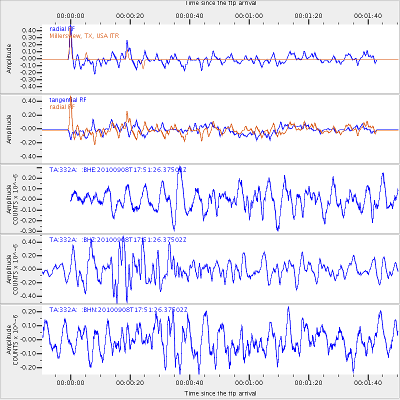
332A Millersview, TX, USA - Earthquake Result Viewer
*The percent match for this event was below the threshold and hence no stack was calculated.
| Earthquake location: |
Kuril Islands |
| Earthquake latitude/longitude: |
44.6/149.7 |
| Earthquake time(UTC): |
2010/09/08 (251) 17:39:40 GMT |
| Earthquake Depth: |
10 km |
| Earthquake Magnitude: |
5.5 MB, 5.3 MS, 5.5 MW |
| Earthquake Catalog/Contributor: |
WHDF/NEIC |
|
| Network: |
TA USArray Transportable Network (new EarthScope stations) |
| Station: |
332A Millersview, TX, USA |
| Lat/Lon: |
31.38 N/99.74 W |
| Elevation: |
513 m |
|
| Distance: |
81.5 deg |
| Az: |
54.082 deg |
| Baz: |
317.421 deg |
| Ray Param: |
$rayparam |
*The percent match for this event was below the threshold and hence was not used in the summary stack. |
|
| Radial Match: |
60.745316 % |
| Radial Bump: |
399 |
| Transverse Match: |
56.810757 % |
| Transverse Bump: |
400 |
| SOD ConfigId: |
319893 |
| Insert Time: |
2011-01-13 09:21:32.244 +0000 |
| GWidth: |
2.5 |
| Max Bumps: |
400 |
| Tol: |
0.001 |
|
Signal To Noise
| Channel | StoN | STA | LTA |
| TA:332A: :BHZ:20100908T17:51:26.37502Z | 2.6888788 | 1.8426991E-7 | 6.853038E-8 |
| TA:332A: :BHN:20100908T17:51:26.37502Z | 0.5517066 | 6.1150246E-8 | 1.1083834E-7 |
| TA:332A: :BHE:20100908T17:51:26.37502Z | 1.8654088 | 1.2396801E-7 | 6.645622E-8 |
| Arrivals |
| Ps | |
| PpPs | |
| PsPs/PpSs | |


