You are here: Home > Network List > TA - USArray Transportable Network (new EarthScope stations) Stations List
> Station 335A Moody, TX, USA > Earthquake Result Viewer
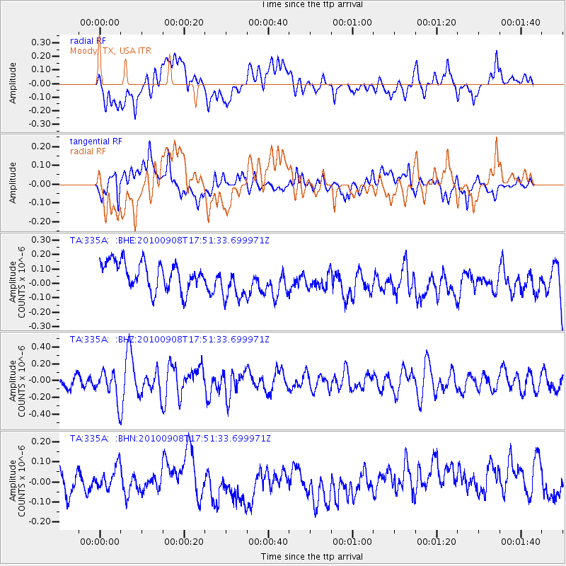
335A Moody, TX, USA - Earthquake Result Viewer
*The percent match for this event was below the threshold and hence no stack was calculated.
| Earthquake location: |
Kuril Islands |
| Earthquake latitude/longitude: |
44.6/149.7 |
| Earthquake time(UTC): |
2010/09/08 (251) 17:39:40 GMT |
| Earthquake Depth: |
10 km |
| Earthquake Magnitude: |
5.5 MB, 5.3 MS, 5.5 MW |
| Earthquake Catalog/Contributor: |
WHDF/NEIC |
|
| Network: |
TA USArray Transportable Network (new EarthScope stations) |
| Station: |
335A Moody, TX, USA |
| Lat/Lon: |
31.28 N/97.43 W |
| Elevation: |
217 m |
|
| Distance: |
82.9 deg |
| Az: |
52.666 deg |
| Baz: |
318.427 deg |
| Ray Param: |
$rayparam |
*The percent match for this event was below the threshold and hence was not used in the summary stack. |
|
| Radial Match: |
39.0573 % |
| Radial Bump: |
400 |
| Transverse Match: |
48.953915 % |
| Transverse Bump: |
400 |
| SOD ConfigId: |
319893 |
| Insert Time: |
2011-01-13 09:25:00.494 +0000 |
| GWidth: |
2.5 |
| Max Bumps: |
400 |
| Tol: |
0.001 |
|
Signal To Noise
| Channel | StoN | STA | LTA |
| TA:335A: :BHZ:20100908T17:51:33.699971Z | 2.644234 | 1.7591555E-7 | 6.652798E-8 |
| TA:335A: :BHN:20100908T17:51:33.699971Z | 0.78816926 | 6.7603914E-8 | 8.5773344E-8 |
| TA:335A: :BHE:20100908T17:51:33.699971Z | 1.4714389 | 1.3923592E-7 | 9.462569E-8 |
| Arrivals |
| Ps | |
| PpPs | |
| PsPs/PpSs | |


