You are here: Home > Network List > TA - USArray Transportable Network (new EarthScope stations) Stations List
> Station V37A Hulbert, OK, USA > Earthquake Result Viewer
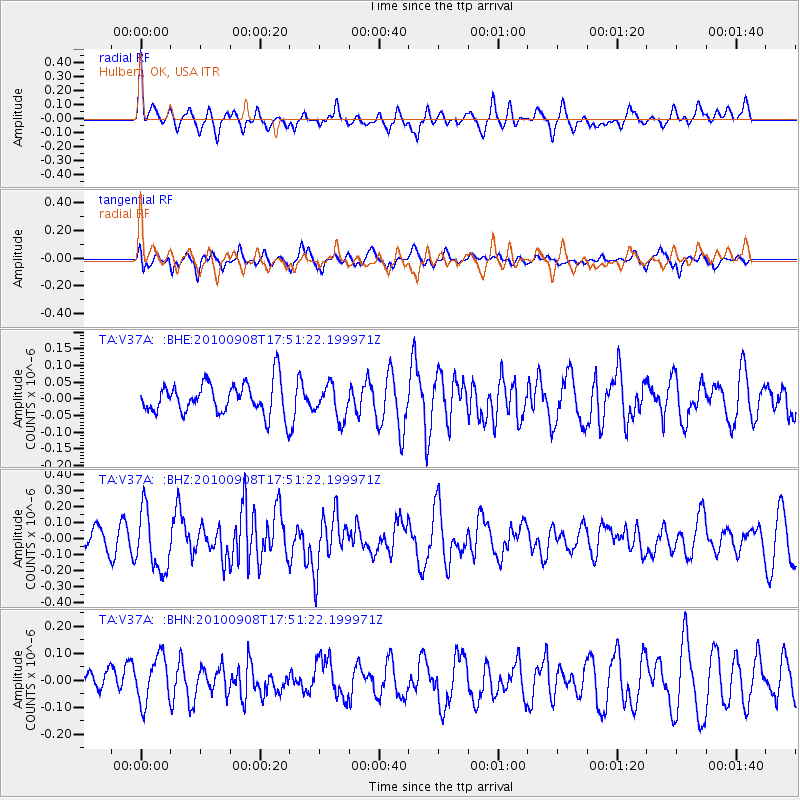
V37A Hulbert, OK, USA - Earthquake Result Viewer
*The percent match for this event was below the threshold and hence no stack was calculated.
| Earthquake location: |
Kuril Islands |
| Earthquake latitude/longitude: |
44.6/149.7 |
| Earthquake time(UTC): |
2010/09/08 (251) 17:39:40 GMT |
| Earthquake Depth: |
10 km |
| Earthquake Magnitude: |
5.5 MB, 5.3 MS, 5.5 MW |
| Earthquake Catalog/Contributor: |
WHDF/NEIC |
|
| Network: |
TA USArray Transportable Network (new EarthScope stations) |
| Station: |
V37A Hulbert, OK, USA |
| Lat/Lon: |
35.88 N/95.14 W |
| Elevation: |
219 m |
|
| Distance: |
80.7 deg |
| Az: |
48.159 deg |
| Baz: |
319.042 deg |
| Ray Param: |
$rayparam |
*The percent match for this event was below the threshold and hence was not used in the summary stack. |
|
| Radial Match: |
62.912247 % |
| Radial Bump: |
400 |
| Transverse Match: |
56.11626 % |
| Transverse Bump: |
400 |
| SOD ConfigId: |
319893 |
| Insert Time: |
2011-01-13 09:26:35.400 +0000 |
| GWidth: |
2.5 |
| Max Bumps: |
400 |
| Tol: |
0.001 |
|
Signal To Noise
| Channel | StoN | STA | LTA |
| TA:V37A: :BHZ:20100908T17:51:22.199971Z | 3.1008277 | 1.8912796E-7 | 6.099274E-8 |
| TA:V37A: :BHN:20100908T17:51:22.199971Z | 1.6701717 | 8.7546525E-8 | 5.241768E-8 |
| TA:V37A: :BHE:20100908T17:51:22.199971Z | 1.0601766 | 5.0375466E-8 | 4.751611E-8 |
| Arrivals |
| Ps | |
| PpPs | |
| PsPs/PpSs | |


