You are here: Home > Network List > TA - USArray Transportable Network (new EarthScope stations) Stations List
> Station S37A Fort Scott, KS, USA > Earthquake Result Viewer
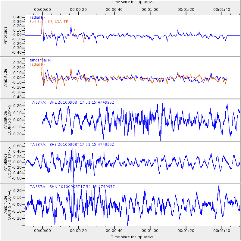
S37A Fort Scott, KS, USA - Earthquake Result Viewer
*The percent match for this event was below the threshold and hence no stack was calculated.
| Earthquake location: |
Kuril Islands |
| Earthquake latitude/longitude: |
44.6/149.7 |
| Earthquake time(UTC): |
2010/09/08 (251) 17:39:40 GMT |
| Earthquake Depth: |
10 km |
| Earthquake Magnitude: |
5.5 MB, 5.3 MS, 5.5 MW |
| Earthquake Catalog/Contributor: |
WHDF/NEIC |
|
| Network: |
TA USArray Transportable Network (new EarthScope stations) |
| Station: |
S37A Fort Scott, KS, USA |
| Lat/Lon: |
37.76 N/94.83 W |
| Elevation: |
260 m |
|
| Distance: |
79.4 deg |
| Az: |
46.719 deg |
| Baz: |
318.981 deg |
| Ray Param: |
$rayparam |
*The percent match for this event was below the threshold and hence was not used in the summary stack. |
|
| Radial Match: |
51.10563 % |
| Radial Bump: |
393 |
| Transverse Match: |
50.26784 % |
| Transverse Bump: |
400 |
| SOD ConfigId: |
319893 |
| Insert Time: |
2011-01-13 09:26:48.656 +0000 |
| GWidth: |
2.5 |
| Max Bumps: |
400 |
| Tol: |
0.001 |
|
Signal To Noise
| Channel | StoN | STA | LTA |
| TA:S37A: :BHZ:20100908T17:51:15.474995Z | 2.2534082 | 1.947272E-7 | 8.641454E-8 |
| TA:S37A: :BHN:20100908T17:51:15.474995Z | 1.316892 | 7.884374E-8 | 5.987108E-8 |
| TA:S37A: :BHE:20100908T17:51:15.474995Z | 1.292623 | 1.0776451E-7 | 8.336886E-8 |
| Arrivals |
| Ps | |
| PpPs | |
| PsPs/PpSs | |


