You are here: Home > Network List > TA - USArray Transportable Network (new EarthScope stations) Stations List
> Station E34A Wadena, MN, USA > Earthquake Result Viewer
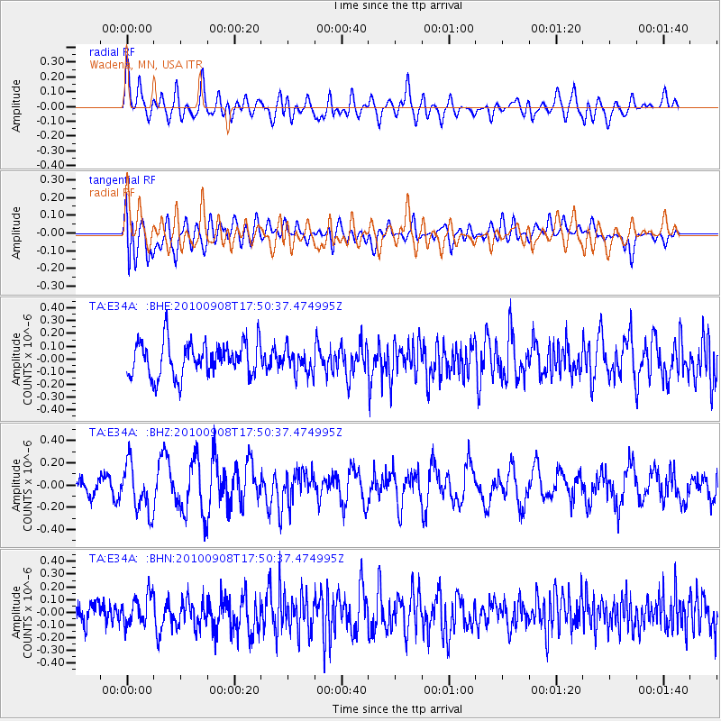
E34A Wadena, MN, USA - Earthquake Result Viewer
*The percent match for this event was below the threshold and hence no stack was calculated.
| Earthquake location: |
Kuril Islands |
| Earthquake latitude/longitude: |
44.6/149.7 |
| Earthquake time(UTC): |
2010/09/08 (251) 17:39:40 GMT |
| Earthquake Depth: |
10 km |
| Earthquake Magnitude: |
5.5 MB, 5.3 MS, 5.5 MW |
| Earthquake Catalog/Contributor: |
WHDF/NEIC |
|
| Network: |
TA USArray Transportable Network (new EarthScope stations) |
| Station: |
E34A Wadena, MN, USA |
| Lat/Lon: |
46.51 N/95.17 W |
| Elevation: |
430 m |
|
| Distance: |
72.7 deg |
| Az: |
40.907 deg |
| Baz: |
317.351 deg |
| Ray Param: |
$rayparam |
*The percent match for this event was below the threshold and hence was not used in the summary stack. |
|
| Radial Match: |
45.66036 % |
| Radial Bump: |
400 |
| Transverse Match: |
51.84024 % |
| Transverse Bump: |
400 |
| SOD ConfigId: |
319893 |
| Insert Time: |
2011-01-13 09:27:28.183 +0000 |
| GWidth: |
2.5 |
| Max Bumps: |
400 |
| Tol: |
0.001 |
|
Signal To Noise
| Channel | StoN | STA | LTA |
| TA:E34A: :BHZ:20100908T17:50:37.474995Z | 2.732243 | 2.1812471E-7 | 7.983356E-8 |
| TA:E34A: :BHN:20100908T17:50:37.474995Z | 1.0570799 | 1.1948717E-7 | 1.1303513E-7 |
| TA:E34A: :BHE:20100908T17:50:37.474995Z | 0.7257134 | 9.8040665E-8 | 1.3509558E-7 |
| Arrivals |
| Ps | |
| PpPs | |
| PsPs/PpSs | |


