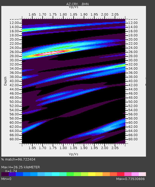
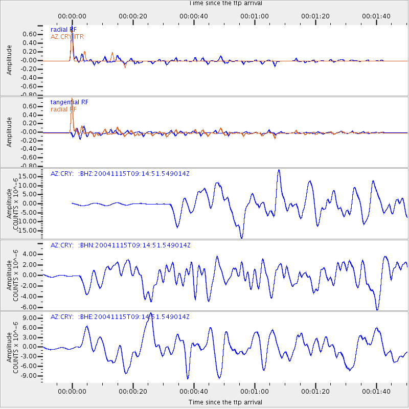
CRY AZ.CRY - Earthquake Result Viewer

Earthquake location: Near West Coast Of Colombia
Earthquake latitude/longitude: 4.7/-77.5
Earthquake time(UTC): 2004/11/15 (320) 09:06:56 GMT
Earthquake Depth: 15 km
Earthquake Magnitude: 6.6 MB, 7.1 MS, 7.2 MW, 7.1 MW
Earthquake Catalog/Contributor: WHDF/NEIC
Network: AZ ANZA Regional Network
Station: CRY AZ.CRY
Lat/Lon: 33.57 N/116.74 W
Elevation: 1128 m
Distance: 46.4 deg
Az: 313.202 deg
Baz: 119.525 deg
Ray Param: 0.07064349
Estimated Moho Depth: 26.25 km
Estimated Crust Vp/Vs: 1.74
Assumed Crust Vp: 6.264 km/s
Estimated Crust Vs: 3.6 km/s
Estimated Crust Poisson's Ratio: 0.25
Radial Match: 96.722404 %
Radial Bump: 246
Transverse Match: 87.72625 %
Transverse Bump: 400
SOD ConfigId: 2459
Insert Time: 2010-02-26 18:55:39.921 +0000
GWidth: 2.5
Max Bumps: 400
Tol: 0.001

Signal To Noise

ChannelStoNSTALTA
AZ:CRY: :BHN:20041115T09:14:51.549014Z4.8861041.2846571E-62.629205E-7
AZ:CRY: :BHE:20041115T09:14:51.549014Z5.5381042.5961285E-64.687757E-7
AZ:CRY: :BHZ:20041115T09:14:51.549014Z11.1437985.22974E-64.6929603E-7
Arrivals
Ps3.3 SECOND
PpPs11 SECOND
PsPs/PpSs14 SECOND