You are here: Home > Network List > US - United States National Seismic Network Stations List
> Station EGMT Eagleton, Montana, USA > Earthquake Result Viewer
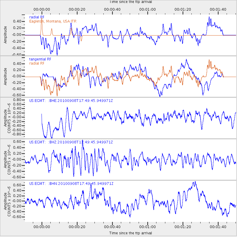
EGMT Eagleton, Montana, USA - Earthquake Result Viewer
*The percent match for this event was below the threshold and hence no stack was calculated.
| Earthquake location: |
Kuril Islands |
| Earthquake latitude/longitude: |
44.6/149.7 |
| Earthquake time(UTC): |
2010/09/08 (251) 17:39:40 GMT |
| Earthquake Depth: |
10 km |
| Earthquake Magnitude: |
5.5 MB, 5.3 MS, 5.5 MW |
| Earthquake Catalog/Contributor: |
WHDF/NEIC |
|
| Network: |
US United States National Seismic Network |
| Station: |
EGMT Eagleton, Montana, USA |
| Lat/Lon: |
48.02 N/109.75 W |
| Elevation: |
1055 m |
|
| Distance: |
64.5 deg |
| Az: |
47.005 deg |
| Baz: |
308.875 deg |
| Ray Param: |
$rayparam |
*The percent match for this event was below the threshold and hence was not used in the summary stack. |
|
| Radial Match: |
31.14244 % |
| Radial Bump: |
400 |
| Transverse Match: |
31.008326 % |
| Transverse Bump: |
400 |
| SOD ConfigId: |
319893 |
| Insert Time: |
2011-01-13 09:28:57.513 +0000 |
| GWidth: |
2.5 |
| Max Bumps: |
400 |
| Tol: |
0.001 |
|
Signal To Noise
| Channel | StoN | STA | LTA |
| US:EGMT: :BHZ:20100908T17:49:45.949971Z | 1.8647057 | 1.9089983E-7 | 1.0237531E-7 |
| US:EGMT: :BHN:20100908T17:49:45.949971Z | 0.59108263 | 1.5684351E-7 | 2.6534954E-7 |
| US:EGMT: :BHE:20100908T17:49:45.949971Z | 0.844157 | 3.3609663E-7 | 3.9814472E-7 |
| Arrivals |
| Ps | |
| PpPs | |
| PsPs/PpSs | |


