You are here: Home > Network List > UW - Pacific Northwest Regional Seismic Network Stations List
> Station PASS Maple Falls, WA, USA > Earthquake Result Viewer
PASS Maple Falls, WA, USA - Earthquake Result Viewer
*The percent match for this event was below the threshold and hence no stack was calculated.
| Earthquake location: |
Kuril Islands |
| Earthquake latitude/longitude: |
44.6/149.7 |
| Earthquake time(UTC): |
2010/09/08 (251) 17:39:40 GMT |
| Earthquake Depth: |
10 km |
| Earthquake Magnitude: |
5.5 MB, 5.3 MS, 5.5 MW |
| Earthquake Catalog/Contributor: |
WHDF/NEIC |
|
| Network: |
UW Pacific Northwest Regional Seismic Network |
| Station: |
PASS Maple Falls, WA, USA |
| Lat/Lon: |
49.00 N/122.09 W |
| Elevation: |
174 m |
|
| Distance: |
57.2 deg |
| Az: |
51.525 deg |
| Baz: |
301.856 deg |
| Ray Param: |
$rayparam |
*The percent match for this event was below the threshold and hence was not used in the summary stack. |
|
| Radial Match: |
45.09658 % |
| Radial Bump: |
400 |
| Transverse Match: |
40.444656 % |
| Transverse Bump: |
400 |
| SOD ConfigId: |
319893 |
| Insert Time: |
2011-01-13 09:29:38.582 +0000 |
| GWidth: |
2.5 |
| Max Bumps: |
400 |
| Tol: |
0.001 |
|
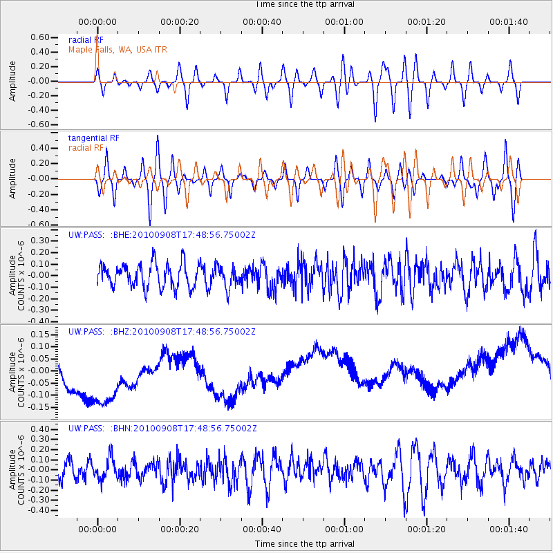
Signal To Noise
| Channel | StoN | STA | LTA |
| UW:PASS: :BHZ:20100908T17:48:56.75002Z | 1.6320033 | 2.9535687E-7 | 1.809781E-7 |
| UW:PASS: :BHN:20100908T17:48:56.75002Z | 1.0761464 | 1.0522687E-7 | 9.778119E-8 |
| UW:PASS: :BHE:20100908T17:48:56.75002Z | 0.90464306 | 9.238642E-8 | 1.0212472E-7 |
| Arrivals |
| Ps | |
| PpPs | |
| PsPs/PpSs | |


