You are here: Home > Network List > US - United States National Seismic Network Stations List
> Station HAWA Hanford, Washington, USA > Earthquake Result Viewer
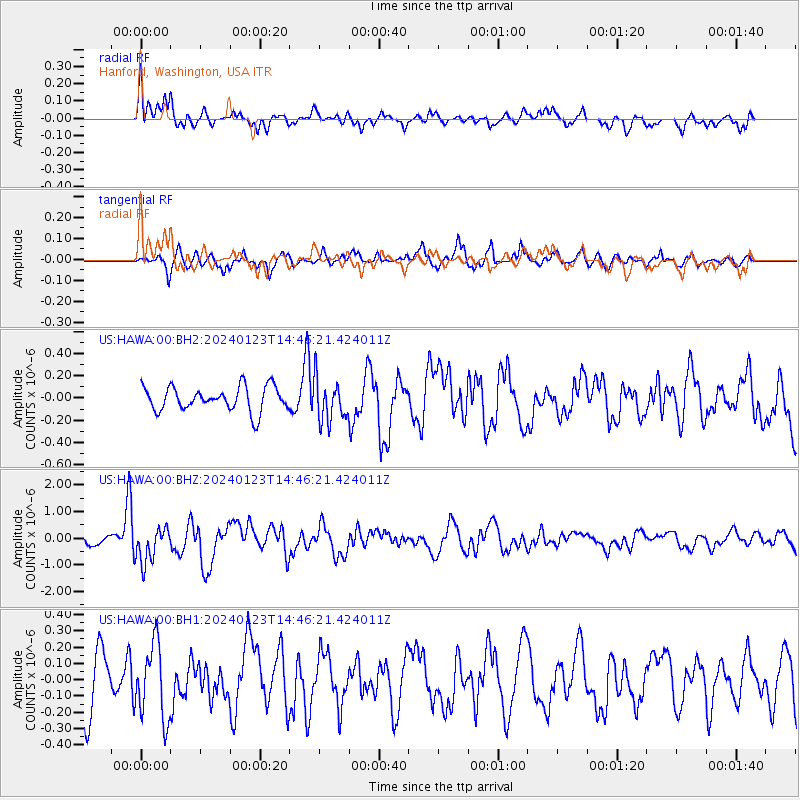
HAWA Hanford, Washington, USA - Earthquake Result Viewer
*The percent match for this event was below the threshold and hence no stack was calculated.
| Earthquake location: |
Vanuatu Islands |
| Earthquake latitude/longitude: |
-17.9/167.8 |
| Earthquake time(UTC): |
2024/01/23 (023) 14:33:47 GMT |
| Earthquake Depth: |
10 km |
| Earthquake Magnitude: |
6.5 Mi |
| Earthquake Catalog/Contributor: |
NEIC PDE/at |
|
| Network: |
US United States National Seismic Network |
| Station: |
HAWA Hanford, Washington, USA |
| Lat/Lon: |
46.39 N/119.53 W |
| Elevation: |
364 m |
|
| Distance: |
91.4 deg |
| Az: |
41.369 deg |
| Baz: |
245.398 deg |
| Ray Param: |
$rayparam |
*The percent match for this event was below the threshold and hence was not used in the summary stack. |
|
| Radial Match: |
77.991295 % |
| Radial Bump: |
400 |
| Transverse Match: |
63.676052 % |
| Transverse Bump: |
400 |
| SOD ConfigId: |
33437571 |
| Insert Time: |
2024-02-06 14:56:08.868 +0000 |
| GWidth: |
2.5 |
| Max Bumps: |
400 |
| Tol: |
0.001 |
|
Signal To Noise
| Channel | StoN | STA | LTA |
| US:HAWA:00:BHZ:20240123T14:46:21.424011Z | 3.578247 | 6.546829E-7 | 1.829619E-7 |
| US:HAWA:00:BH1:20240123T14:46:21.424011Z | 1.2711723 | 2.3014395E-7 | 1.8104859E-7 |
| US:HAWA:00:BH2:20240123T14:46:21.424011Z | 1.7335066 | 1.8927966E-7 | 1.09188896E-7 |
| Arrivals |
| Ps | |
| PpPs | |
| PsPs/PpSs | |


