You are here: Home > Network List > US - United States National Seismic Network Stations List
> Station HAWA Hanford, Washington, USA > Earthquake Result Viewer
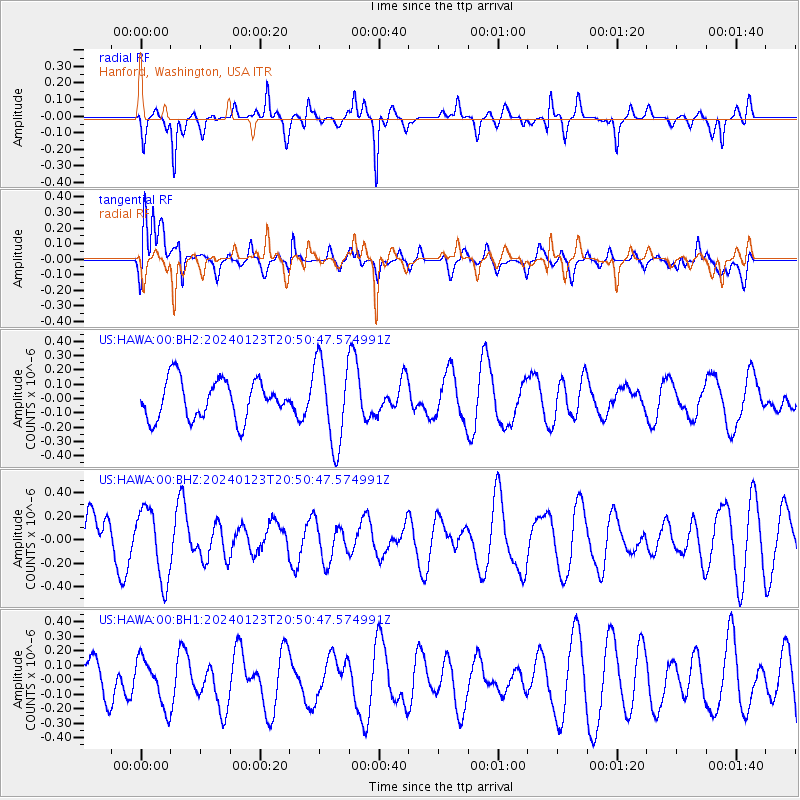
HAWA Hanford, Washington, USA - Earthquake Result Viewer
*The percent match for this event was below the threshold and hence no stack was calculated.
| Earthquake location: |
Kyrgyzstan-Xinjiang Border Reg. |
| Earthquake latitude/longitude: |
41.1/78.6 |
| Earthquake time(UTC): |
2024/01/23 (023) 20:38:13 GMT |
| Earthquake Depth: |
10 km |
| Earthquake Magnitude: |
5.2 Mww |
| Earthquake Catalog/Contributor: |
NEIC PDE/us |
|
| Network: |
US United States National Seismic Network |
| Station: |
HAWA Hanford, Washington, USA |
| Lat/Lon: |
46.39 N/119.53 W |
| Elevation: |
364 m |
|
| Distance: |
91.4 deg |
| Az: |
12.413 deg |
| Baz: |
346.433 deg |
| Ray Param: |
$rayparam |
*The percent match for this event was below the threshold and hence was not used in the summary stack. |
|
| Radial Match: |
67.56384 % |
| Radial Bump: |
371 |
| Transverse Match: |
68.44764 % |
| Transverse Bump: |
400 |
| SOD ConfigId: |
33437571 |
| Insert Time: |
2024-02-06 20:56:00.314 +0000 |
| GWidth: |
2.5 |
| Max Bumps: |
400 |
| Tol: |
0.001 |
|
Signal To Noise
| Channel | StoN | STA | LTA |
| US:HAWA:00:BHZ:20240123T20:50:47.574991Z | 1.6179882 | 3.0320845E-7 | 1.8739844E-7 |
| US:HAWA:00:BH1:20240123T20:50:47.574991Z | 1.4079683 | 1.6393456E-7 | 1.1643341E-7 |
| US:HAWA:00:BH2:20240123T20:50:47.574991Z | 2.1829207 | 2.9542133E-7 | 1.3533305E-7 |
| Arrivals |
| Ps | |
| PpPs | |
| PsPs/PpSs | |


