You are here: Home > Network List > TA - USArray Transportable Network (new EarthScope stations) Stations List
> Station 331A San Angelo, TX, USA > Earthquake Result Viewer
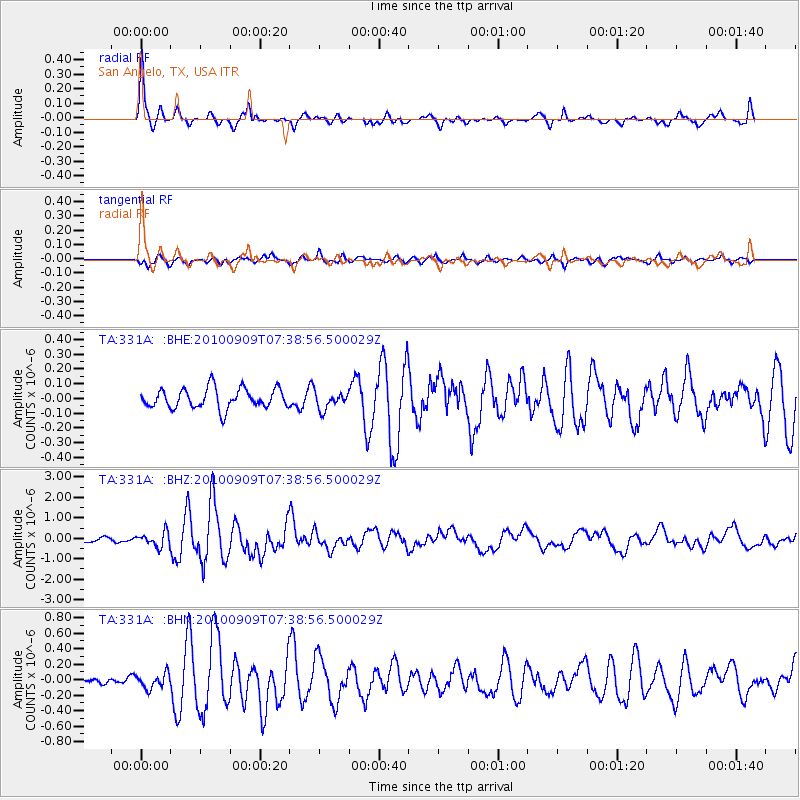
331A San Angelo, TX, USA - Earthquake Result Viewer

| Earthquake location: |
Near Coast Of Central Chile |
| Earthquake latitude/longitude: |
-37.0/-73.4 |
| Earthquake time(UTC): |
2010/09/09 (252) 07:28:01 GMT |
| Earthquake Depth: |
16 km |
| Earthquake Magnitude: |
5.8 MB, 6.0 MS, 6.2 MW, 6.2 MW |
| Earthquake Catalog/Contributor: |
WHDF/NEIC |
|
| Network: |
TA USArray Transportable Network (new EarthScope stations) |
| Station: |
331A San Angelo, TX, USA |
| Lat/Lon: |
31.31 N/100.43 W |
| Elevation: |
615 m |
|
| Distance: |
72.5 deg |
| Az: |
335.948 deg |
| Baz: |
157.602 deg |
| Ray Param: |
0.05358329 |
| Estimated Moho Depth: |
44.5 km |
| Estimated Crust Vp/Vs: |
1.88 |
| Assumed Crust Vp: |
6.38 km/s |
| Estimated Crust Vs: |
3.389 km/s |
| Estimated Crust Poisson's Ratio: |
0.30 |
|
| Radial Match: |
86.342125 % |
| Radial Bump: |
374 |
| Transverse Match: |
72.067955 % |
| Transverse Bump: |
352 |
| SOD ConfigId: |
319893 |
| Insert Time: |
2011-01-13 09:40:39.980 +0000 |
| GWidth: |
2.5 |
| Max Bumps: |
400 |
| Tol: |
0.001 |
|
Signal To Noise
| Channel | StoN | STA | LTA |
| TA:331A: :BHZ:20100909T07:38:56.500029Z | 3.113723 | 3.504591E-7 | 1.1255307E-7 |
| TA:331A: :BHN:20100909T07:38:56.500029Z | 1.1827408 | 9.540373E-8 | 8.0663256E-8 |
| TA:331A: :BHE:20100909T07:38:56.500029Z | 0.86646444 | 5.8334216E-8 | 6.732442E-8 |
| Arrivals |
| Ps | 6.4 SECOND |
| PpPs | 19 SECOND |
| PsPs/PpSs | 26 SECOND |


