You are here: Home > Network List > TA - USArray Transportable Network (new EarthScope stations) Stations List
> Station P32A Huiting Farm, Downs, KS, USA > Earthquake Result Viewer
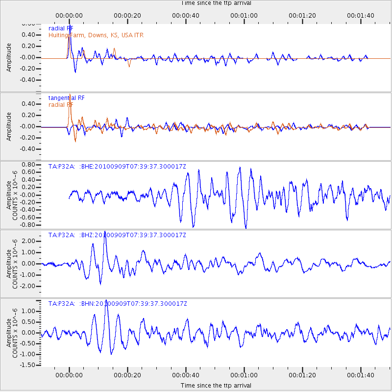
P32A Huiting Farm, Downs, KS, USA - Earthquake Result Viewer

| Earthquake location: |
Near Coast Of Central Chile |
| Earthquake latitude/longitude: |
-37.0/-73.4 |
| Earthquake time(UTC): |
2010/09/09 (252) 07:28:01 GMT |
| Earthquake Depth: |
16 km |
| Earthquake Magnitude: |
5.8 MB, 6.0 MS, 6.2 MW, 6.2 MW |
| Earthquake Catalog/Contributor: |
WHDF/NEIC |
|
| Network: |
TA USArray Transportable Network (new EarthScope stations) |
| Station: |
P32A Huiting Farm, Downs, KS, USA |
| Lat/Lon: |
39.62 N/98.60 W |
| Elevation: |
524 m |
|
| Distance: |
79.7 deg |
| Az: |
340.483 deg |
| Baz: |
159.749 deg |
| Ray Param: |
0.04875271 |
| Estimated Moho Depth: |
32.75 km |
| Estimated Crust Vp/Vs: |
1.67 |
| Assumed Crust Vp: |
6.483 km/s |
| Estimated Crust Vs: |
3.888 km/s |
| Estimated Crust Poisson's Ratio: |
0.22 |
|
| Radial Match: |
92.64243 % |
| Radial Bump: |
341 |
| Transverse Match: |
86.24808 % |
| Transverse Bump: |
400 |
| SOD ConfigId: |
319893 |
| Insert Time: |
2011-01-13 09:47:59.915 +0000 |
| GWidth: |
2.5 |
| Max Bumps: |
400 |
| Tol: |
0.001 |
|
Signal To Noise
| Channel | StoN | STA | LTA |
| TA:P32A: :BHZ:20100909T07:39:37.300017Z | 3.1125906 | 2.0992005E-7 | 6.744223E-8 |
| TA:P32A: :BHN:20100909T07:39:37.300017Z | 0.70809984 | 8.784361E-8 | 1.240554E-7 |
| TA:P32A: :BHE:20100909T07:39:37.300017Z | 1.7047487 | 1.5217559E-7 | 8.92657E-8 |
| Arrivals |
| Ps | 3.5 SECOND |
| PpPs | 13 SECOND |
| PsPs/PpSs | 17 SECOND |


