You are here: Home > Network List > UW - Pacific Northwest Regional Seismic Network Stations List
> Station UMAT Pilot Rock, OR, USA > Earthquake Result Viewer
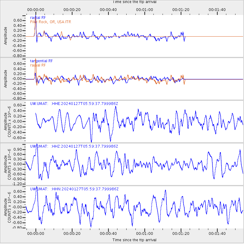
UMAT Pilot Rock, OR, USA - Earthquake Result Viewer
*The percent match for this event was below the threshold and hence no stack was calculated.
| Earthquake location: |
Guatemala |
| Earthquake latitude/longitude: |
14.1/-90.5 |
| Earthquake time(UTC): |
2024/01/27 (027) 05:52:49 GMT |
| Earthquake Depth: |
108 km |
| Earthquake Magnitude: |
6.1 Mww |
| Earthquake Catalog/Contributor: |
NEIC PDE/us |
|
| Network: |
UW Pacific Northwest Regional Seismic Network |
| Station: |
UMAT Pilot Rock, OR, USA |
| Lat/Lon: |
45.29 N/118.96 W |
| Elevation: |
1318 m |
|
| Distance: |
39.3 deg |
| Az: |
327.943 deg |
| Baz: |
133.156 deg |
| Ray Param: |
$rayparam |
*The percent match for this event was below the threshold and hence was not used in the summary stack. |
|
| Radial Match: |
74.91352 % |
| Radial Bump: |
400 |
| Transverse Match: |
59.31188 % |
| Transverse Bump: |
400 |
| SOD ConfigId: |
33437571 |
| Insert Time: |
2024-02-10 06:21:38.677 +0000 |
| GWidth: |
2.5 |
| Max Bumps: |
400 |
| Tol: |
0.001 |
|
Signal To Noise
| Channel | StoN | STA | LTA |
| UW:UMAT: :HHZ:20240127T05:59:37.799986Z | 3.7406971 | 7.0581046E-7 | 1.8868421E-7 |
| UW:UMAT: :HHN:20240127T05:59:37.799986Z | 3.768076 | 4.3683568E-7 | 1.15930696E-7 |
| UW:UMAT: :HHE:20240127T05:59:37.799986Z | 1.5257653 | 3.0927993E-7 | 2.0270478E-7 |
| Arrivals |
| Ps | |
| PpPs | |
| PsPs/PpSs | |


