You are here: Home > Network List > CI - Caltech Regional Seismic Network Stations List
> Station SWS Sam W. Stewart, Westmorland, CA, USA > Earthquake Result Viewer
SWS Sam W. Stewart, Westmorland, CA, USA - Earthquake Result Viewer
*The percent match for this event was below the threshold and hence no stack was calculated.
| Earthquake location: |
Western Brazil |
| Earthquake latitude/longitude: |
-8.2/-71.4 |
| Earthquake time(UTC): |
2024/01/28 (028) 09:38:56 GMT |
| Earthquake Depth: |
609 km |
| Earthquake Magnitude: |
6.5 Mww |
| Earthquake Catalog/Contributor: |
NEIC PDE/us |
|
| Network: |
CI Caltech Regional Seismic Network |
| Station: |
SWS Sam W. Stewart, Westmorland, CA, USA |
| Lat/Lon: |
32.94 N/115.80 W |
| Elevation: |
140 m |
|
| Distance: |
58.8 deg |
| Az: |
316.531 deg |
| Baz: |
125.919 deg |
| Ray Param: |
$rayparam |
*The percent match for this event was below the threshold and hence was not used in the summary stack. |
|
| Radial Match: |
58.08007 % |
| Radial Bump: |
277 |
| Transverse Match: |
75.990265 % |
| Transverse Bump: |
308 |
| SOD ConfigId: |
33437571 |
| Insert Time: |
2024-02-11 09:51:35.768 +0000 |
| GWidth: |
2.5 |
| Max Bumps: |
400 |
| Tol: |
0.001 |
|
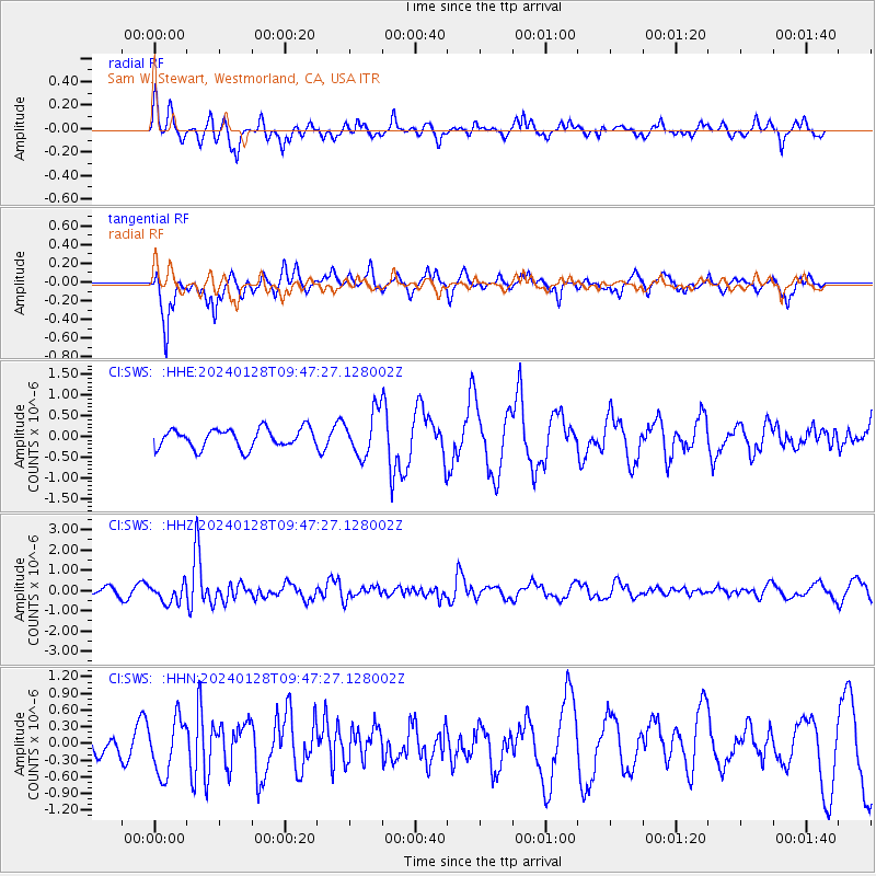
Signal To Noise
| Channel | StoN | STA | LTA |
| CI:SWS: :HHZ:20240128T09:47:27.128002Z | 3.4833567 | 4.7076628E-7 | 1.351473E-7 |
| CI:SWS: :HHN:20240128T09:47:27.128002Z | 1.4751651 | 4.893685E-7 | 3.317381E-7 |
| CI:SWS: :HHE:20240128T09:47:27.128002Z | 2.2785738 | 5.259469E-7 | 2.3082286E-7 |
| Arrivals |
| Ps | |
| PpPs | |
| PsPs/PpSs | |


