You are here: Home > Network List > US - United States National Seismic Network Stations List
> Station HAWA Hanford, Washington, USA > Earthquake Result Viewer
HAWA Hanford, Washington, USA - Earthquake Result Viewer
*The percent match for this event was below the threshold and hence no stack was calculated.
| Earthquake location: |
Western Brazil |
| Earthquake latitude/longitude: |
-8.2/-71.4 |
| Earthquake time(UTC): |
2024/01/28 (028) 09:38:56 GMT |
| Earthquake Depth: |
609 km |
| Earthquake Magnitude: |
6.5 Mww |
| Earthquake Catalog/Contributor: |
NEIC PDE/us |
|
| Network: |
US United States National Seismic Network |
| Station: |
HAWA Hanford, Washington, USA |
| Lat/Lon: |
46.39 N/119.53 W |
| Elevation: |
364 m |
|
| Distance: |
69.2 deg |
| Az: |
326.529 deg |
| Baz: |
127.931 deg |
| Ray Param: |
$rayparam |
*The percent match for this event was below the threshold and hence was not used in the summary stack. |
|
| Radial Match: |
66.14908 % |
| Radial Bump: |
400 |
| Transverse Match: |
64.10821 % |
| Transverse Bump: |
400 |
| SOD ConfigId: |
33437571 |
| Insert Time: |
2024-02-11 10:13:26.144 +0000 |
| GWidth: |
2.5 |
| Max Bumps: |
400 |
| Tol: |
0.001 |
|
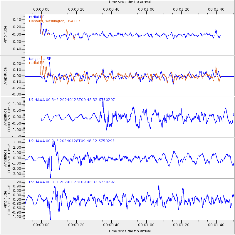
Signal To Noise
| Channel | StoN | STA | LTA |
| US:HAWA:00:BHZ:20240128T09:48:32.675029Z | 3.537983 | 7.215766E-7 | 2.0395142E-7 |
| US:HAWA:00:BH1:20240128T09:48:32.675029Z | 0.9540446 | 2.7476594E-7 | 2.8800116E-7 |
| US:HAWA:00:BH2:20240128T09:48:32.675029Z | 1.8726181 | 2.859422E-7 | 1.526965E-7 |
| Arrivals |
| Ps | |
| PpPs | |
| PsPs/PpSs | |


