You are here: Home > Network List > US - United States National Seismic Network Stations List
> Station AMTX Amarillo, Texas, USA > Earthquake Result Viewer
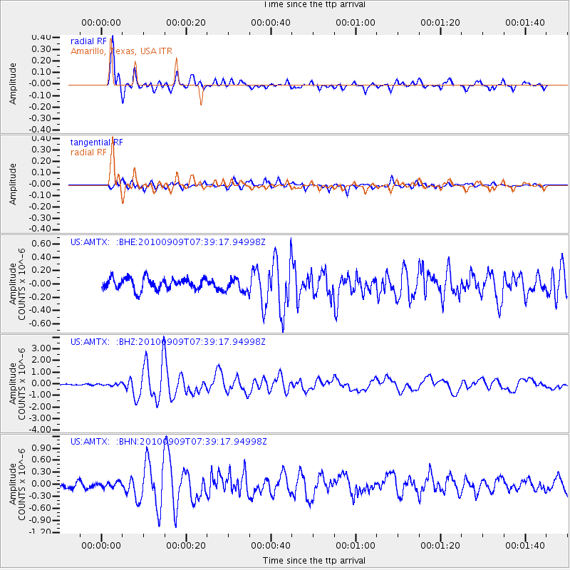
AMTX Amarillo, Texas, USA - Earthquake Result Viewer
*The percent match for this event was below the threshold and hence no stack was calculated.
| Earthquake location: |
Near Coast Of Central Chile |
| Earthquake latitude/longitude: |
-37.0/-73.4 |
| Earthquake time(UTC): |
2010/09/09 (252) 07:28:01 GMT |
| Earthquake Depth: |
16 km |
| Earthquake Magnitude: |
5.8 MB, 6.0 MS, 6.2 MW, 6.2 MW |
| Earthquake Catalog/Contributor: |
WHDF/NEIC |
|
| Network: |
US United States National Seismic Network |
| Station: |
AMTX Amarillo, Texas, USA |
| Lat/Lon: |
34.53 N/101.41 W |
| Elevation: |
1010 m |
|
| Distance: |
75.8 deg |
| Az: |
336.439 deg |
| Baz: |
157.205 deg |
| Ray Param: |
$rayparam |
*The percent match for this event was below the threshold and hence was not used in the summary stack. |
|
| Radial Match: |
94.42442 % |
| Radial Bump: |
341 |
| Transverse Match: |
77.23044 % |
| Transverse Bump: |
400 |
| SOD ConfigId: |
319893 |
| Insert Time: |
2011-01-13 10:01:48.109 +0000 |
| GWidth: |
2.5 |
| Max Bumps: |
400 |
| Tol: |
0.001 |
|
Signal To Noise
| Channel | StoN | STA | LTA |
| US:AMTX: :BHZ:20100909T07:39:17.94998Z | 1.0717796 | 9.544881E-8 | 8.905638E-8 |
| US:AMTX: :BHN:20100909T07:39:17.94998Z | 0.7774783 | 6.121281E-8 | 7.8732505E-8 |
| US:AMTX: :BHE:20100909T07:39:17.94998Z | 0.967997 | 8.477198E-8 | 8.7574634E-8 |
| Arrivals |
| Ps | |
| PpPs | |
| PsPs/PpSs | |


