You are here: Home > Network List > US - United States National Seismic Network Stations List
> Station DUG Dugway, Tooele County, Utah, USA > Earthquake Result Viewer
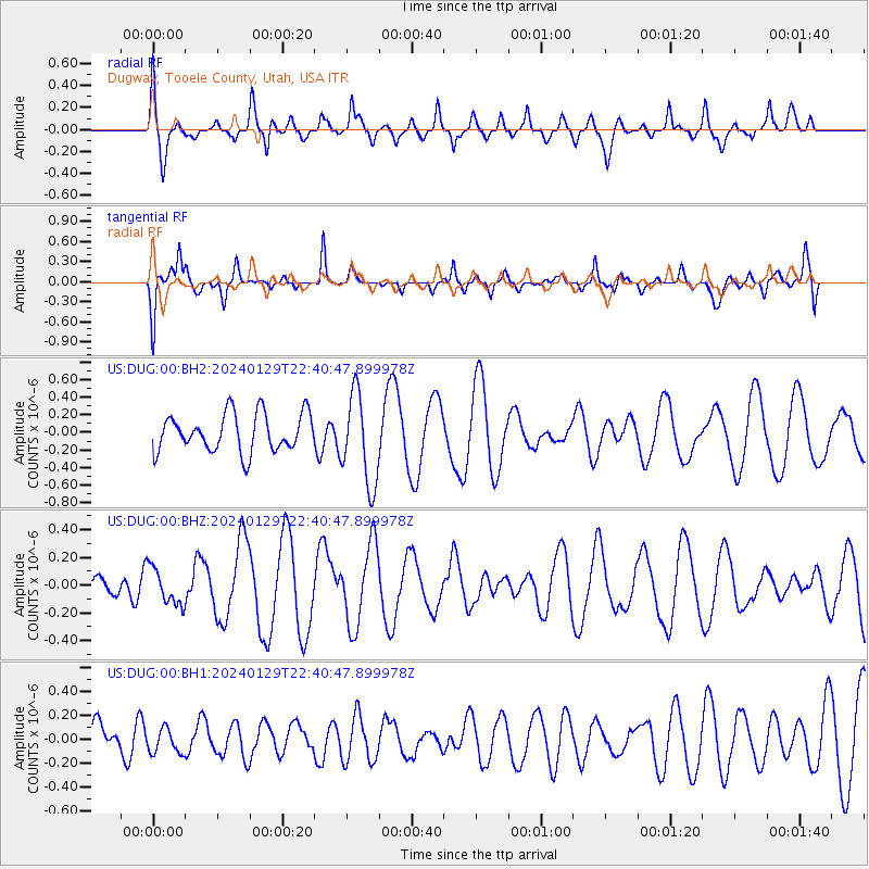
DUG Dugway, Tooele County, Utah, USA - Earthquake Result Viewer
*The percent match for this event was below the threshold and hence no stack was calculated.
| Earthquake location: |
Kyrgyzstan-Xinjiang Border Reg. |
| Earthquake latitude/longitude: |
41.2/78.7 |
| Earthquake time(UTC): |
2024/01/29 (029) 22:27:41 GMT |
| Earthquake Depth: |
10 km |
| Earthquake Magnitude: |
5.7 mww |
| Earthquake Catalog/Contributor: |
NEIC PDE/us |
|
| Network: |
US United States National Seismic Network |
| Station: |
DUG Dugway, Tooele County, Utah, USA |
| Lat/Lon: |
40.19 N/112.81 W |
| Elevation: |
1477 m |
|
| Distance: |
98.3 deg |
| Az: |
8.901 deg |
| Baz: |
351.231 deg |
| Ray Param: |
$rayparam |
*The percent match for this event was below the threshold and hence was not used in the summary stack. |
|
| Radial Match: |
62.54141 % |
| Radial Bump: |
400 |
| Transverse Match: |
63.90032 % |
| Transverse Bump: |
400 |
| SOD ConfigId: |
33437571 |
| Insert Time: |
2024-02-12 22:45:15.599 +0000 |
| GWidth: |
2.5 |
| Max Bumps: |
400 |
| Tol: |
0.001 |
|
Signal To Noise
| Channel | StoN | STA | LTA |
| US:DUG:00:BHZ:20240129T22:40:47.899978Z | 2.1833875 | 1.3195763E-7 | 6.043711E-8 |
| US:DUG:00:BH1:20240129T22:40:47.899978Z | 0.42613938 | 1.0530875E-7 | 2.4712278E-7 |
| US:DUG:00:BH2:20240129T22:40:47.899978Z | 2.4155967 | 5.1900645E-7 | 2.1485641E-7 |
| Arrivals |
| Ps | |
| PpPs | |
| PsPs/PpSs | |


