You are here: Home > Network List > G - GEOSCOPE Stations List
> Station INU Inuyama, Japan > Earthquake Result Viewer
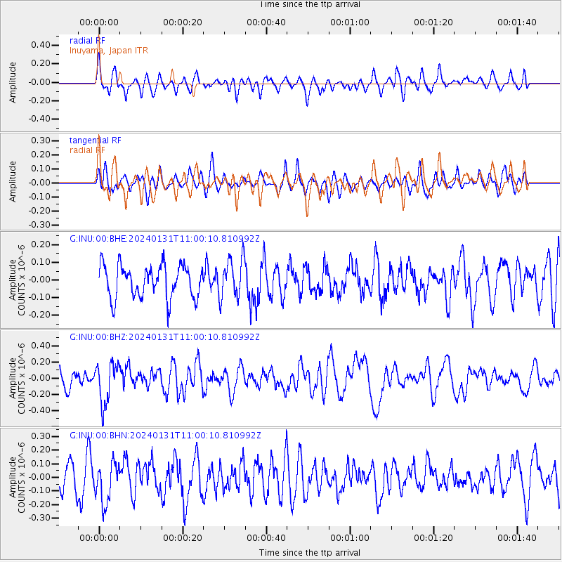
INU Inuyama, Japan - Earthquake Result Viewer
*The percent match for this event was below the threshold and hence no stack was calculated.
| Earthquake location: |
South Of Fiji Islands |
| Earthquake latitude/longitude: |
-22.8/-177.1 |
| Earthquake time(UTC): |
2024/01/31 (031) 10:49:36 GMT |
| Earthquake Depth: |
185 km |
| Earthquake Magnitude: |
5.8 mww |
| Earthquake Catalog/Contributor: |
NEIC PDE/us |
|
| Network: |
G GEOSCOPE |
| Station: |
INU Inuyama, Japan |
| Lat/Lon: |
35.35 N/137.03 E |
| Elevation: |
132 m |
|
| Distance: |
72.3 deg |
| Az: |
322.023 deg |
| Baz: |
136.015 deg |
| Ray Param: |
$rayparam |
*The percent match for this event was below the threshold and hence was not used in the summary stack. |
|
| Radial Match: |
55.77956 % |
| Radial Bump: |
400 |
| Transverse Match: |
45.575195 % |
| Transverse Bump: |
400 |
| SOD ConfigId: |
33437571 |
| Insert Time: |
2024-02-14 11:02:26.437 +0000 |
| GWidth: |
2.5 |
| Max Bumps: |
400 |
| Tol: |
0.001 |
|
Signal To Noise
| Channel | StoN | STA | LTA |
| G:INU:00:BHZ:20240131T11:00:10.810992Z | 2.7273104 | 2.5362897E-7 | 9.2996004E-8 |
| G:INU:00:BHN:20240131T11:00:10.810992Z | 1.2881598 | 1.5285478E-7 | 1.1866134E-7 |
| G:INU:00:BHE:20240131T11:00:10.810992Z | 1.2366616 | 1.1384591E-7 | 9.205907E-8 |
| Arrivals |
| Ps | |
| PpPs | |
| PsPs/PpSs | |


