You are here: Home > Network List > UW - Pacific Northwest Regional Seismic Network Stations List
> Station IRON Crane, OR, USA > Earthquake Result Viewer
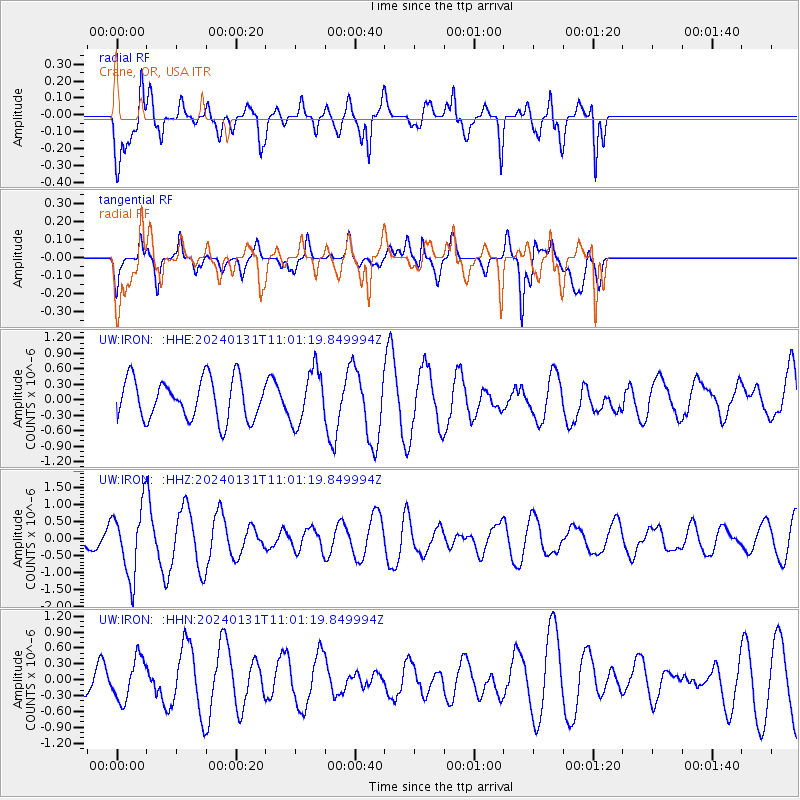
IRON Crane, OR, USA - Earthquake Result Viewer
*The percent match for this event was below the threshold and hence no stack was calculated.
| Earthquake location: |
South Of Fiji Islands |
| Earthquake latitude/longitude: |
-22.8/-177.1 |
| Earthquake time(UTC): |
2024/01/31 (031) 10:49:36 GMT |
| Earthquake Depth: |
185 km |
| Earthquake Magnitude: |
5.8 mww |
| Earthquake Catalog/Contributor: |
NEIC PDE/us |
|
| Network: |
UW Pacific Northwest Regional Seismic Network |
| Station: |
IRON Crane, OR, USA |
| Lat/Lon: |
43.36 N/118.47 W |
| Elevation: |
1226 m |
|
| Distance: |
85.1 deg |
| Az: |
38.704 deg |
| Baz: |
232.273 deg |
| Ray Param: |
$rayparam |
*The percent match for this event was below the threshold and hence was not used in the summary stack. |
|
| Radial Match: |
76.922844 % |
| Radial Bump: |
400 |
| Transverse Match: |
48.057247 % |
| Transverse Bump: |
400 |
| SOD ConfigId: |
33437571 |
| Insert Time: |
2024-02-14 11:13:36.344 +0000 |
| GWidth: |
2.5 |
| Max Bumps: |
400 |
| Tol: |
0.001 |
|
Signal To Noise
| Channel | StoN | STA | LTA |
| UW:IRON: :HHZ:20240131T11:01:19.849994Z | 6.7694244 | 1.003554E-6 | 1.4824806E-7 |
| UW:IRON: :HHN:20240131T11:01:19.849994Z | 0.86406314 | 3.9210022E-7 | 4.537865E-7 |
| UW:IRON: :HHE:20240131T11:01:19.849994Z | 1.3151683 | 5.1797184E-7 | 3.9384454E-7 |
| Arrivals |
| Ps | |
| PpPs | |
| PsPs/PpSs | |


