You are here: Home > Network List > CI - Caltech Regional Seismic Network Stations List
> Station BAR Barrett, Tecate, CA, USA > Earthquake Result Viewer
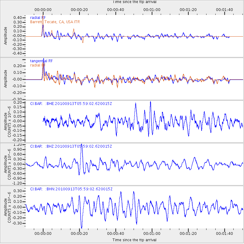
BAR Barrett, Tecate, CA, USA - Earthquake Result Viewer
*The percent match for this event was below the threshold and hence no stack was calculated.
| Earthquake location: |
Hokkaido, Japan Region |
| Earthquake latitude/longitude: |
41.5/142.0 |
| Earthquake time(UTC): |
2010/09/13 (256) 05:47:48 GMT |
| Earthquake Depth: |
61 km |
| Earthquake Magnitude: |
5.8 MB, 5.8 MW, 5.8 MW |
| Earthquake Catalog/Contributor: |
WHDF/NEIC |
|
| Network: |
CI Caltech Regional Seismic Network |
| Station: |
BAR Barrett, Tecate, CA, USA |
| Lat/Lon: |
32.68 N/116.67 W |
| Elevation: |
521 m |
|
| Distance: |
76.7 deg |
| Az: |
58.175 deg |
| Baz: |
310.81 deg |
| Ray Param: |
$rayparam |
*The percent match for this event was below the threshold and hence was not used in the summary stack. |
|
| Radial Match: |
72.747986 % |
| Radial Bump: |
400 |
| Transverse Match: |
76.71278 % |
| Transverse Bump: |
400 |
| SOD ConfigId: |
319893 |
| Insert Time: |
2011-01-20 07:40:24.183 +0000 |
| GWidth: |
2.5 |
| Max Bumps: |
400 |
| Tol: |
0.001 |
|
Signal To Noise
| Channel | StoN | STA | LTA |
| CI:BAR: :BHZ:20100913T05:59:02.620015Z | 2.5589476 | 2.0983454E-7 | 8.200033E-8 |
| CI:BAR: :BHN:20100913T05:59:02.620015Z | 0.89414316 | 6.258746E-8 | 6.999714E-8 |
| CI:BAR: :BHE:20100913T05:59:02.620015Z | 1.8927373 | 5.5059562E-8 | 2.9089913E-8 |
| Arrivals |
| Ps | |
| PpPs | |
| PsPs/PpSs | |


