You are here: Home > Network List > CI - Caltech Regional Seismic Network Stations List
> Station LRL Laurel Mtn Radio Fac, Ridgecrest, CA, USA > Earthquake Result Viewer
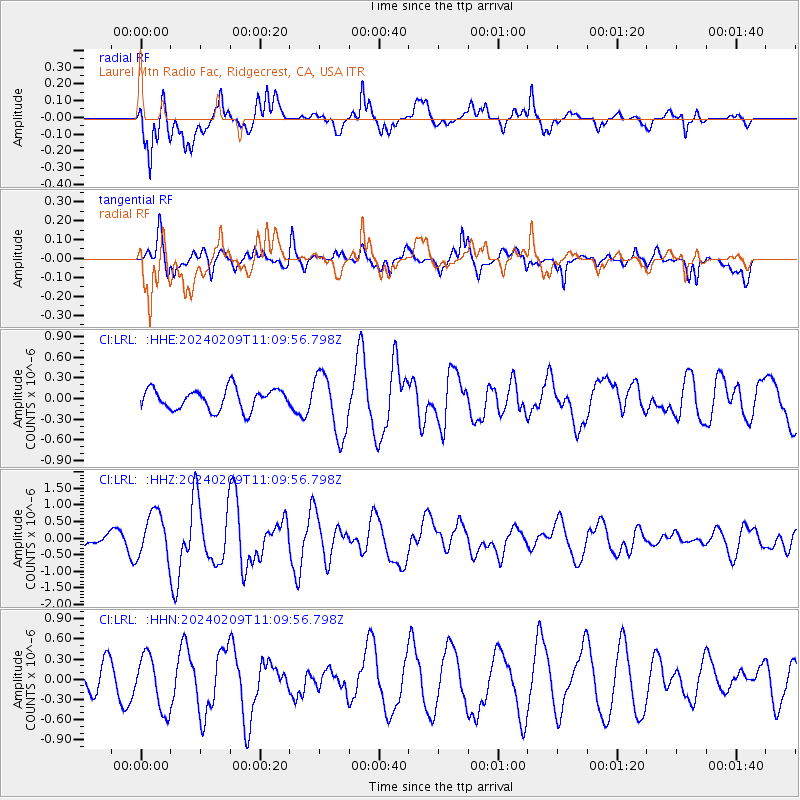
LRL Laurel Mtn Radio Fac, Ridgecrest, CA, USA - Earthquake Result Viewer
*The percent match for this event was below the threshold and hence no stack was calculated.
| Earthquake location: |
Kermadec Islands, New Zealand |
| Earthquake latitude/longitude: |
-29.9/-177.3 |
| Earthquake time(UTC): |
2024/02/09 (040) 10:57:48 GMT |
| Earthquake Depth: |
10 km |
| Earthquake Magnitude: |
6.1 mww |
| Earthquake Catalog/Contributor: |
NEIC PDE/us |
|
| Network: |
CI Caltech Regional Seismic Network |
| Station: |
LRL Laurel Mtn Radio Fac, Ridgecrest, CA, USA |
| Lat/Lon: |
35.48 N/117.68 W |
| Elevation: |
1340 m |
|
| Distance: |
85.9 deg |
| Az: |
44.898 deg |
| Baz: |
228.667 deg |
| Ray Param: |
$rayparam |
*The percent match for this event was below the threshold and hence was not used in the summary stack. |
|
| Radial Match: |
72.05407 % |
| Radial Bump: |
400 |
| Transverse Match: |
71.285774 % |
| Transverse Bump: |
400 |
| SOD ConfigId: |
33437571 |
| Insert Time: |
2024-02-23 11:07:23.033 +0000 |
| GWidth: |
2.5 |
| Max Bumps: |
400 |
| Tol: |
0.001 |
|
Signal To Noise
| Channel | StoN | STA | LTA |
| CI:LRL: :HHZ:20240209T11:09:56.798Z | 4.1324687 | 6.8615344E-7 | 1.660396E-7 |
| CI:LRL: :HHN:20240209T11:09:56.798Z | 1.420297 | 4.031287E-7 | 2.8383408E-7 |
| CI:LRL: :HHE:20240209T11:09:56.798Z | 2.9939895 | 4.520103E-7 | 1.5097257E-7 |
| Arrivals |
| Ps | |
| PpPs | |
| PsPs/PpSs | |


