You are here: Home > Network List > TA - USArray Transportable Network (new EarthScope stations) Stations List
> Station V28A Channing, TX, USA > Earthquake Result Viewer
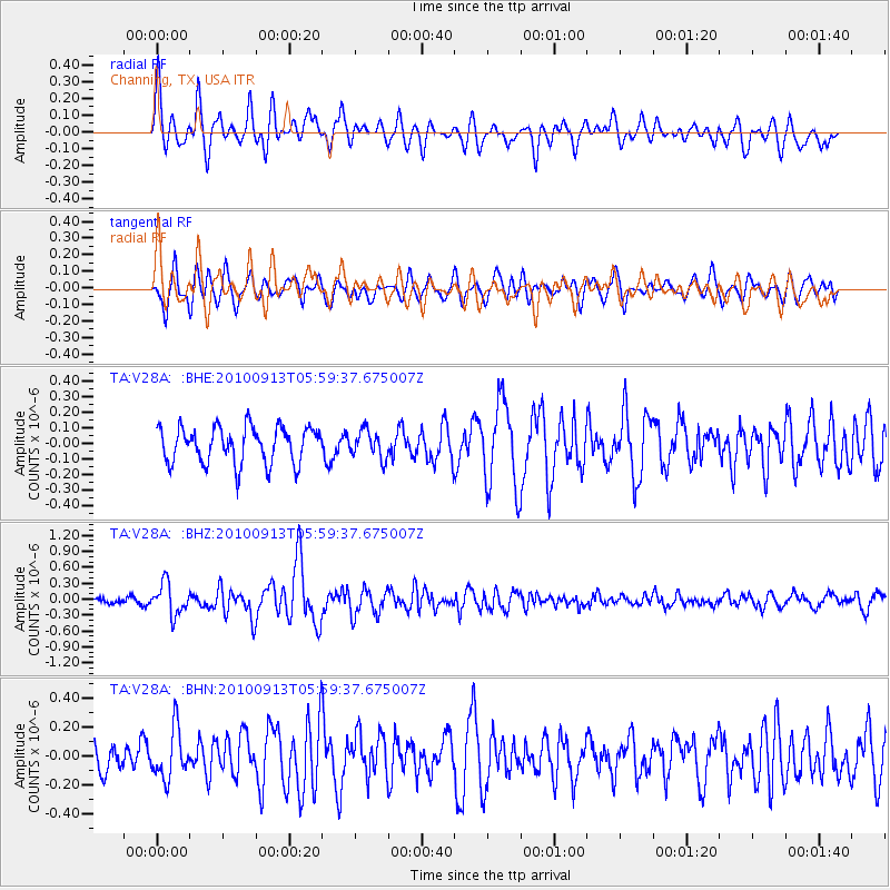
V28A Channing, TX, USA - Earthquake Result Viewer
*The percent match for this event was below the threshold and hence no stack was calculated.
| Earthquake location: |
Hokkaido, Japan Region |
| Earthquake latitude/longitude: |
41.5/142.0 |
| Earthquake time(UTC): |
2010/09/13 (256) 05:47:48 GMT |
| Earthquake Depth: |
61 km |
| Earthquake Magnitude: |
5.8 MB, 5.8 MW, 5.8 MW |
| Earthquake Catalog/Contributor: |
WHDF/NEIC |
|
| Network: |
TA USArray Transportable Network (new EarthScope stations) |
| Station: |
V28A Channing, TX, USA |
| Lat/Lon: |
35.75 N/102.22 W |
| Elevation: |
1163 m |
|
| Distance: |
83.2 deg |
| Az: |
47.523 deg |
| Baz: |
317.064 deg |
| Ray Param: |
$rayparam |
*The percent match for this event was below the threshold and hence was not used in the summary stack. |
|
| Radial Match: |
67.45796 % |
| Radial Bump: |
400 |
| Transverse Match: |
62.667942 % |
| Transverse Bump: |
400 |
| SOD ConfigId: |
319893 |
| Insert Time: |
2011-01-20 07:54:27.725 +0000 |
| GWidth: |
2.5 |
| Max Bumps: |
400 |
| Tol: |
0.001 |
|
Signal To Noise
| Channel | StoN | STA | LTA |
| TA:V28A: :BHZ:20100913T05:59:37.675007Z | 3.8118153 | 2.9711197E-7 | 7.794501E-8 |
| TA:V28A: :BHN:20100913T05:59:37.675007Z | 1.4909177 | 1.672298E-7 | 1.1216569E-7 |
| TA:V28A: :BHE:20100913T05:59:37.675007Z | 0.7591307 | 8.778515E-8 | 1.1563905E-7 |
| Arrivals |
| Ps | |
| PpPs | |
| PsPs/PpSs | |


