You are here: Home > Network List > UW - Pacific Northwest Regional Seismic Network Stations List
> Station UMAT Pilot Rock, OR, USA > Earthquake Result Viewer
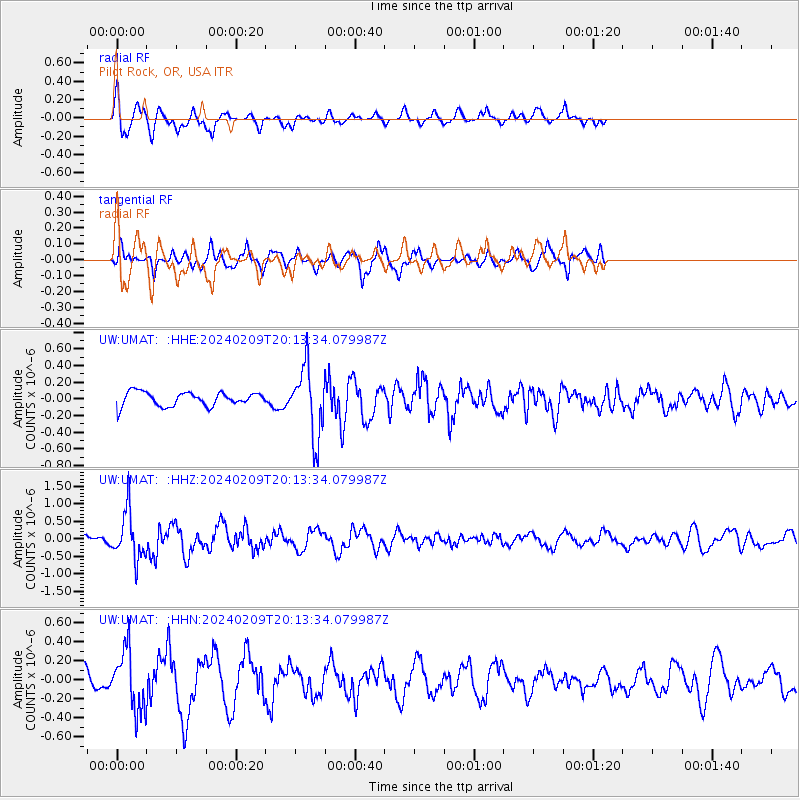
UMAT Pilot Rock, OR, USA - Earthquake Result Viewer
*The percent match for this event was below the threshold and hence no stack was calculated.
| Earthquake location: |
Hawaii |
| Earthquake latitude/longitude: |
19.0/-155.5 |
| Earthquake time(UTC): |
2024/02/09 (040) 20:06:30 GMT |
| Earthquake Depth: |
10 km |
| Earthquake Magnitude: |
6.3 Mi |
| Earthquake Catalog/Contributor: |
NEIC PDE/pt |
|
| Network: |
UW Pacific Northwest Regional Seismic Network |
| Station: |
UMAT Pilot Rock, OR, USA |
| Lat/Lon: |
45.29 N/118.96 W |
| Elevation: |
1318 m |
|
| Distance: |
40.0 deg |
| Az: |
40.865 deg |
| Baz: |
241.259 deg |
| Ray Param: |
$rayparam |
*The percent match for this event was below the threshold and hence was not used in the summary stack. |
|
| Radial Match: |
70.098625 % |
| Radial Bump: |
400 |
| Transverse Match: |
57.433174 % |
| Transverse Bump: |
380 |
| SOD ConfigId: |
33437571 |
| Insert Time: |
2024-02-23 20:38:50.778 +0000 |
| GWidth: |
2.5 |
| Max Bumps: |
400 |
| Tol: |
0.001 |
|
Signal To Noise
| Channel | StoN | STA | LTA |
| UW:UMAT: :HHZ:20240209T20:13:34.079987Z | 4.836282 | 6.7850635E-7 | 1.4029506E-7 |
| UW:UMAT: :HHN:20240209T20:13:34.079987Z | 2.3101501 | 3.0881577E-7 | 1.3367779E-7 |
| UW:UMAT: :HHE:20240209T20:13:34.079987Z | 4.918491 | 4.1725065E-7 | 8.483306E-8 |
| Arrivals |
| Ps | |
| PpPs | |
| PsPs/PpSs | |


