You are here: Home > Network List > TA - USArray Transportable Network (new EarthScope stations) Stations List
> Station R31A Burdett, KS, USA > Earthquake Result Viewer
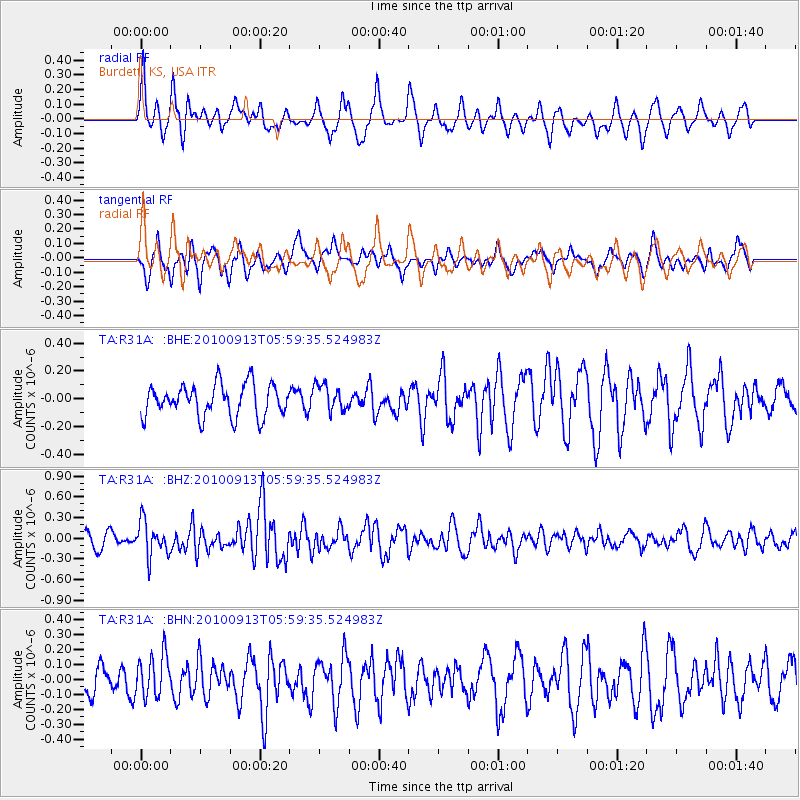
R31A Burdett, KS, USA - Earthquake Result Viewer
*The percent match for this event was below the threshold and hence no stack was calculated.
| Earthquake location: |
Hokkaido, Japan Region |
| Earthquake latitude/longitude: |
41.5/142.0 |
| Earthquake time(UTC): |
2010/09/13 (256) 05:47:48 GMT |
| Earthquake Depth: |
61 km |
| Earthquake Magnitude: |
5.8 MB, 5.8 MW, 5.8 MW |
| Earthquake Catalog/Contributor: |
WHDF/NEIC |
|
| Network: |
TA USArray Transportable Network (new EarthScope stations) |
| Station: |
R31A Burdett, KS, USA |
| Lat/Lon: |
38.29 N/99.53 W |
| Elevation: |
667 m |
|
| Distance: |
82.8 deg |
| Az: |
44.197 deg |
| Baz: |
318.277 deg |
| Ray Param: |
$rayparam |
*The percent match for this event was below the threshold and hence was not used in the summary stack. |
|
| Radial Match: |
72.04545 % |
| Radial Bump: |
400 |
| Transverse Match: |
58.085266 % |
| Transverse Bump: |
388 |
| SOD ConfigId: |
319893 |
| Insert Time: |
2011-01-20 08:01:35.251 +0000 |
| GWidth: |
2.5 |
| Max Bumps: |
400 |
| Tol: |
0.001 |
|
Signal To Noise
| Channel | StoN | STA | LTA |
| TA:R31A: :BHZ:20100913T05:59:35.524983Z | 2.9487708 | 2.4873566E-7 | 8.435232E-8 |
| TA:R31A: :BHN:20100913T05:59:35.524983Z | 1.045705 | 1.4105902E-7 | 1.348937E-7 |
| TA:R31A: :BHE:20100913T05:59:35.524983Z | 0.8152421 | 9.4011234E-8 | 1.1531694E-7 |
| Arrivals |
| Ps | |
| PpPs | |
| PsPs/PpSs | |


