You are here: Home > Network List > TA - USArray Transportable Network (new EarthScope stations) Stations List
> Station O30A M W Ranch, Wilsonville, NE, USA > Earthquake Result Viewer
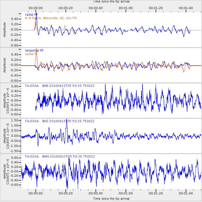
O30A M W Ranch, Wilsonville, NE, USA - Earthquake Result Viewer
*The percent match for this event was below the threshold and hence no stack was calculated.
| Earthquake location: |
Hokkaido, Japan Region |
| Earthquake latitude/longitude: |
41.5/142.0 |
| Earthquake time(UTC): |
2010/09/13 (256) 05:47:48 GMT |
| Earthquake Depth: |
61 km |
| Earthquake Magnitude: |
5.8 MB, 5.8 MW, 5.8 MW |
| Earthquake Catalog/Contributor: |
WHDF/NEIC |
|
| Network: |
TA USArray Transportable Network (new EarthScope stations) |
| Station: |
O30A M W Ranch, Wilsonville, NE, USA |
| Lat/Lon: |
40.18 N/100.06 W |
| Elevation: |
751 m |
|
| Distance: |
81.1 deg |
| Az: |
43.232 deg |
| Baz: |
317.808 deg |
| Ray Param: |
$rayparam |
*The percent match for this event was below the threshold and hence was not used in the summary stack. |
|
| Radial Match: |
68.96862 % |
| Radial Bump: |
400 |
| Transverse Match: |
66.82575 % |
| Transverse Bump: |
400 |
| SOD ConfigId: |
319893 |
| Insert Time: |
2011-01-20 08:02:11.034 +0000 |
| GWidth: |
2.5 |
| Max Bumps: |
400 |
| Tol: |
0.001 |
|
Signal To Noise
| Channel | StoN | STA | LTA |
| TA:O30A: :BHZ:20100913T05:59:26.75002Z | 3.583468 | 3.5078466E-7 | 9.788972E-8 |
| TA:O30A: :BHN:20100913T05:59:26.75002Z | 1.1356727 | 2.3999826E-7 | 2.1132698E-7 |
| TA:O30A: :BHE:20100913T05:59:26.75002Z | 1.190759 | 2.1207399E-7 | 1.7809984E-7 |
| Arrivals |
| Ps | |
| PpPs | |
| PsPs/PpSs | |


