You are here: Home > Network List > TA - USArray Transportable Network (new EarthScope stations) Stations List
> Station H26A Fairpoint, SD, USA > Earthquake Result Viewer
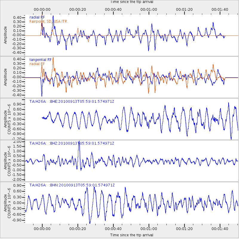
H26A Fairpoint, SD, USA - Earthquake Result Viewer
*The percent match for this event was below the threshold and hence no stack was calculated.
| Earthquake location: |
Hokkaido, Japan Region |
| Earthquake latitude/longitude: |
41.5/142.0 |
| Earthquake time(UTC): |
2010/09/13 (256) 05:47:48 GMT |
| Earthquake Depth: |
61 km |
| Earthquake Magnitude: |
5.8 MB, 5.8 MW, 5.8 MW |
| Earthquake Catalog/Contributor: |
WHDF/NEIC |
|
| Network: |
TA USArray Transportable Network (new EarthScope stations) |
| Station: |
H26A Fairpoint, SD, USA |
| Lat/Lon: |
44.62 N/102.77 W |
| Elevation: |
879 m |
|
| Distance: |
76.5 deg |
| Az: |
41.629 deg |
| Baz: |
315.67 deg |
| Ray Param: |
$rayparam |
*The percent match for this event was below the threshold and hence was not used in the summary stack. |
|
| Radial Match: |
57.753544 % |
| Radial Bump: |
400 |
| Transverse Match: |
43.17354 % |
| Transverse Bump: |
400 |
| SOD ConfigId: |
319893 |
| Insert Time: |
2011-01-20 08:03:16.062 +0000 |
| GWidth: |
2.5 |
| Max Bumps: |
400 |
| Tol: |
0.001 |
|
Signal To Noise
| Channel | StoN | STA | LTA |
| TA:H26A: :BHZ:20100913T05:59:01.574971Z | 3.1036158 | 4.0109467E-7 | 1.2923464E-7 |
| TA:H26A: :BHN:20100913T05:59:01.574971Z | 1.253376 | 3.3170937E-7 | 2.6465273E-7 |
| TA:H26A: :BHE:20100913T05:59:01.574971Z | 1.1053735 | 3.235011E-7 | 2.9266226E-7 |
| Arrivals |
| Ps | |
| PpPs | |
| PsPs/PpSs | |


