You are here: Home > Network List > TA - USArray Transportable Network (new EarthScope stations) Stations List
> Station 535A Dale, TX, USA > Earthquake Result Viewer
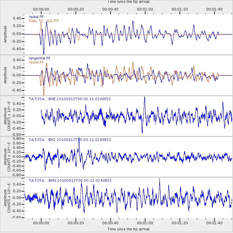
535A Dale, TX, USA - Earthquake Result Viewer
*The percent match for this event was below the threshold and hence no stack was calculated.
| Earthquake location: |
Hokkaido, Japan Region |
| Earthquake latitude/longitude: |
41.5/142.0 |
| Earthquake time(UTC): |
2010/09/13 (256) 05:47:48 GMT |
| Earthquake Depth: |
61 km |
| Earthquake Magnitude: |
5.8 MB, 5.8 MW, 5.8 MW |
| Earthquake Catalog/Contributor: |
WHDF/NEIC |
|
| Network: |
TA USArray Transportable Network (new EarthScope stations) |
| Station: |
535A Dale, TX, USA |
| Lat/Lon: |
30.03 N/97.57 W |
| Elevation: |
170 m |
|
| Distance: |
90.1 deg |
| Az: |
48.388 deg |
| Baz: |
319.634 deg |
| Ray Param: |
$rayparam |
*The percent match for this event was below the threshold and hence was not used in the summary stack. |
|
| Radial Match: |
61.56798 % |
| Radial Bump: |
400 |
| Transverse Match: |
66.75047 % |
| Transverse Bump: |
393 |
| SOD ConfigId: |
319893 |
| Insert Time: |
2011-01-20 08:10:59.022 +0000 |
| GWidth: |
2.5 |
| Max Bumps: |
400 |
| Tol: |
0.001 |
|
Signal To Noise
| Channel | StoN | STA | LTA |
| TA:535A: :BHZ:20100913T06:00:11.024983Z | 2.5795982 | 2.2050286E-7 | 8.547954E-8 |
| TA:535A: :BHN:20100913T06:00:11.024983Z | 1.2053596 | 1.3211218E-7 | 1.0960395E-7 |
| TA:535A: :BHE:20100913T06:00:11.024983Z | 0.88254666 | 1.0234739E-7 | 1.1596825E-7 |
| Arrivals |
| Ps | |
| PpPs | |
| PsPs/PpSs | |


