You are here: Home > Network List > CI - Caltech Regional Seismic Network Stations List
> Station BFS Mt Baldy Forest Station > Earthquake Result Viewer
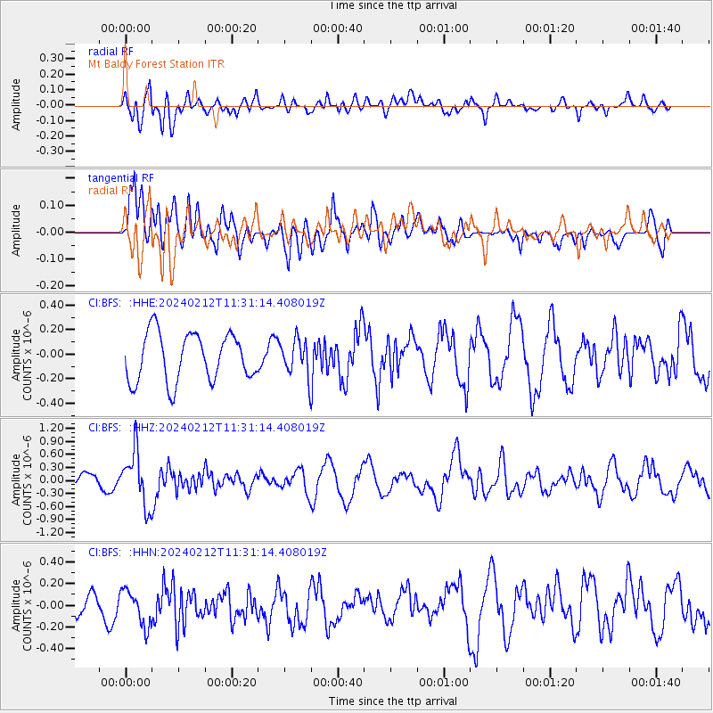
BFS Mt Baldy Forest Station - Earthquake Result Viewer
*The percent match for this event was below the threshold and hence no stack was calculated.
| Earthquake location: |
Volcano Islands, Japan Region |
| Earthquake latitude/longitude: |
22.0/142.7 |
| Earthquake time(UTC): |
2024/02/12 (043) 11:19:36 GMT |
| Earthquake Depth: |
250 km |
| Earthquake Magnitude: |
6.1 mww |
| Earthquake Catalog/Contributor: |
NEIC PDE/us |
|
| Network: |
CI Caltech Regional Seismic Network |
| Station: |
BFS Mt Baldy Forest Station |
| Lat/Lon: |
34.24 N/117.66 W |
| Elevation: |
1312 m |
|
| Distance: |
85.4 deg |
| Az: |
55.038 deg |
| Baz: |
293.383 deg |
| Ray Param: |
$rayparam |
*The percent match for this event was below the threshold and hence was not used in the summary stack. |
|
| Radial Match: |
62.40332 % |
| Radial Bump: |
400 |
| Transverse Match: |
58.56232 % |
| Transverse Bump: |
400 |
| SOD ConfigId: |
33437571 |
| Insert Time: |
2024-02-26 11:32:17.585 +0000 |
| GWidth: |
2.5 |
| Max Bumps: |
400 |
| Tol: |
0.001 |
|
Signal To Noise
| Channel | StoN | STA | LTA |
| CI:BFS: :HHZ:20240212T11:31:14.408019Z | 3.667637 | 6.306173E-7 | 1.7194104E-7 |
| CI:BFS: :HHN:20240212T11:31:14.408019Z | 2.0076296 | 1.7120713E-7 | 8.527824E-8 |
| CI:BFS: :HHE:20240212T11:31:14.408019Z | 0.7465518 | 1.454971E-7 | 1.9489215E-7 |
| Arrivals |
| Ps | |
| PpPs | |
| PsPs/PpSs | |


