You are here: Home > Network List > IW - Intermountain West Stations List
> Station MOOW Moose Ponds, Wyoming, USA > Earthquake Result Viewer
MOOW Moose Ponds, Wyoming, USA - Earthquake Result Viewer
*The percent match for this event was below the threshold and hence no stack was calculated.
| Earthquake location: |
Volcano Islands, Japan Region |
| Earthquake latitude/longitude: |
22.0/142.7 |
| Earthquake time(UTC): |
2024/02/12 (043) 11:19:36 GMT |
| Earthquake Depth: |
250 km |
| Earthquake Magnitude: |
6.1 mww |
| Earthquake Catalog/Contributor: |
NEIC PDE/us |
|
| Network: |
IW Intermountain West |
| Station: |
MOOW Moose Ponds, Wyoming, USA |
| Lat/Lon: |
43.75 N/110.74 W |
| Elevation: |
2128 m |
|
| Distance: |
86.2 deg |
| Az: |
44.133 deg |
| Baz: |
296.933 deg |
| Ray Param: |
$rayparam |
*The percent match for this event was below the threshold and hence was not used in the summary stack. |
|
| Radial Match: |
53.508583 % |
| Radial Bump: |
400 |
| Transverse Match: |
47.868572 % |
| Transverse Bump: |
400 |
| SOD ConfigId: |
33437571 |
| Insert Time: |
2024-02-26 11:38:10.876 +0000 |
| GWidth: |
2.5 |
| Max Bumps: |
400 |
| Tol: |
0.001 |
|
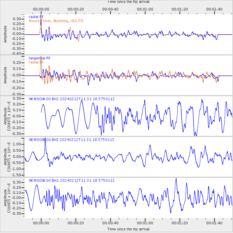
Signal To Noise
| Channel | StoN | STA | LTA |
| IW:MOOW:00:BHZ:20240212T11:31:18.575011Z | 3.4457579 | 5.073213E-7 | 1.4723071E-7 |
| IW:MOOW:00:BH1:20240212T11:31:18.575011Z | 0.69041526 | 7.426002E-8 | 1.0755849E-7 |
| IW:MOOW:00:BH2:20240212T11:31:18.575011Z | 1.188789 | 1.6647901E-7 | 1.4004084E-7 |
| Arrivals |
| Ps | |
| PpPs | |
| PsPs/PpSs | |


