You are here: Home > Network List > TA - USArray Transportable Network (new EarthScope stations) Stations List
> Station H31A Wolsey, SD, USA > Earthquake Result Viewer
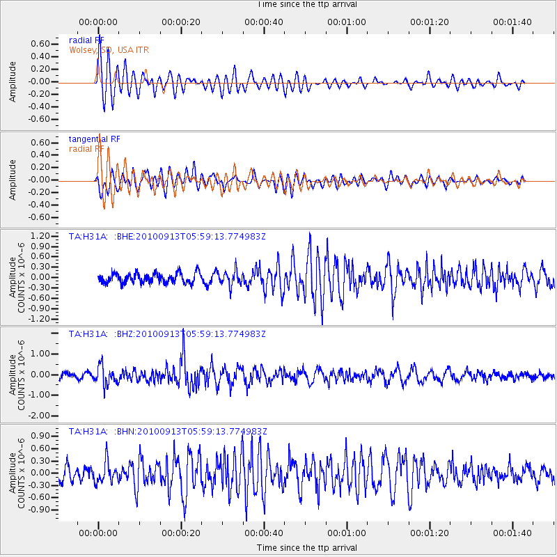
H31A Wolsey, SD, USA - Earthquake Result Viewer
*The percent match for this event was below the threshold and hence no stack was calculated.
| Earthquake location: |
Hokkaido, Japan Region |
| Earthquake latitude/longitude: |
41.5/142.0 |
| Earthquake time(UTC): |
2010/09/13 (256) 05:47:48 GMT |
| Earthquake Depth: |
61 km |
| Earthquake Magnitude: |
5.8 MB, 5.8 MW, 5.8 MW |
| Earthquake Catalog/Contributor: |
WHDF/NEIC |
|
| Network: |
TA USArray Transportable Network (new EarthScope stations) |
| Station: |
H31A Wolsey, SD, USA |
| Lat/Lon: |
44.48 N/98.48 W |
| Elevation: |
415 m |
|
| Distance: |
78.7 deg |
| Az: |
39.427 deg |
| Baz: |
318.202 deg |
| Ray Param: |
$rayparam |
*The percent match for this event was below the threshold and hence was not used in the summary stack. |
|
| Radial Match: |
72.92312 % |
| Radial Bump: |
400 |
| Transverse Match: |
71.07852 % |
| Transverse Bump: |
400 |
| SOD ConfigId: |
319893 |
| Insert Time: |
2011-01-20 08:20:07.943 +0000 |
| GWidth: |
2.5 |
| Max Bumps: |
400 |
| Tol: |
0.001 |
|
Signal To Noise
| Channel | StoN | STA | LTA |
| TA:H31A: :BHZ:20100913T05:59:13.774983Z | 3.0397449 | 4.6671224E-7 | 1.5353665E-7 |
| TA:H31A: :BHN:20100913T05:59:13.774983Z | 1.5157822 | 2.600462E-7 | 1.7155907E-7 |
| TA:H31A: :BHE:20100913T05:59:13.774983Z | 1.4279643 | 2.0531702E-7 | 1.4378303E-7 |
| Arrivals |
| Ps | |
| PpPs | |
| PsPs/PpSs | |


