You are here: Home > Network List > US - United States National Seismic Network Stations List
> Station HAWA Hanford, Washington, USA > Earthquake Result Viewer
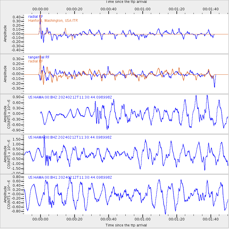
HAWA Hanford, Washington, USA - Earthquake Result Viewer
*The percent match for this event was below the threshold and hence no stack was calculated.
| Earthquake location: |
Volcano Islands, Japan Region |
| Earthquake latitude/longitude: |
22.0/142.7 |
| Earthquake time(UTC): |
2024/02/12 (043) 11:19:36 GMT |
| Earthquake Depth: |
250 km |
| Earthquake Magnitude: |
6.1 mww |
| Earthquake Catalog/Contributor: |
NEIC PDE/us |
|
| Network: |
US United States National Seismic Network |
| Station: |
HAWA Hanford, Washington, USA |
| Lat/Lon: |
46.39 N/119.53 W |
| Elevation: |
364 m |
|
| Distance: |
79.5 deg |
| Az: |
44.237 deg |
| Baz: |
290.737 deg |
| Ray Param: |
$rayparam |
*The percent match for this event was below the threshold and hence was not used in the summary stack. |
|
| Radial Match: |
54.80266 % |
| Radial Bump: |
400 |
| Transverse Match: |
48.132034 % |
| Transverse Bump: |
390 |
| SOD ConfigId: |
33437571 |
| Insert Time: |
2024-02-26 11:45:47.755 +0000 |
| GWidth: |
2.5 |
| Max Bumps: |
400 |
| Tol: |
0.001 |
|
Signal To Noise
| Channel | StoN | STA | LTA |
| US:HAWA:00:BHZ:20240212T11:30:44.098998Z | 3.4795513 | 7.043519E-7 | 2.0242608E-7 |
| US:HAWA:00:BH1:20240212T11:30:44.098998Z | 1.1781565 | 4.0952244E-7 | 3.4759597E-7 |
| US:HAWA:00:BH2:20240212T11:30:44.098998Z | 1.571984 | 2.8947596E-7 | 1.8414688E-7 |
| Arrivals |
| Ps | |
| PpPs | |
| PsPs/PpSs | |


