You are here: Home > Network List > US - United States National Seismic Network Stations List
> Station OGNE Ogallala, Nebraska, USA > Earthquake Result Viewer
OGNE Ogallala, Nebraska, USA - Earthquake Result Viewer
*The percent match for this event was below the threshold and hence no stack was calculated.
| Earthquake location: |
Volcano Islands, Japan Region |
| Earthquake latitude/longitude: |
22.0/142.7 |
| Earthquake time(UTC): |
2024/02/12 (043) 11:19:36 GMT |
| Earthquake Depth: |
250 km |
| Earthquake Magnitude: |
6.1 mww |
| Earthquake Catalog/Contributor: |
NEIC PDE/us |
|
| Network: |
US United States National Seismic Network |
| Station: |
OGNE Ogallala, Nebraska, USA |
| Lat/Lon: |
40.95 N/102.03 W |
| Elevation: |
1054 m |
|
| Distance: |
93.2 deg |
| Az: |
43.344 deg |
| Baz: |
302.784 deg |
| Ray Param: |
$rayparam |
*The percent match for this event was below the threshold and hence was not used in the summary stack. |
|
| Radial Match: |
46.079483 % |
| Radial Bump: |
400 |
| Transverse Match: |
50.09444 % |
| Transverse Bump: |
400 |
| SOD ConfigId: |
33437571 |
| Insert Time: |
2024-02-26 11:46:00.369 +0000 |
| GWidth: |
2.5 |
| Max Bumps: |
400 |
| Tol: |
0.001 |
|
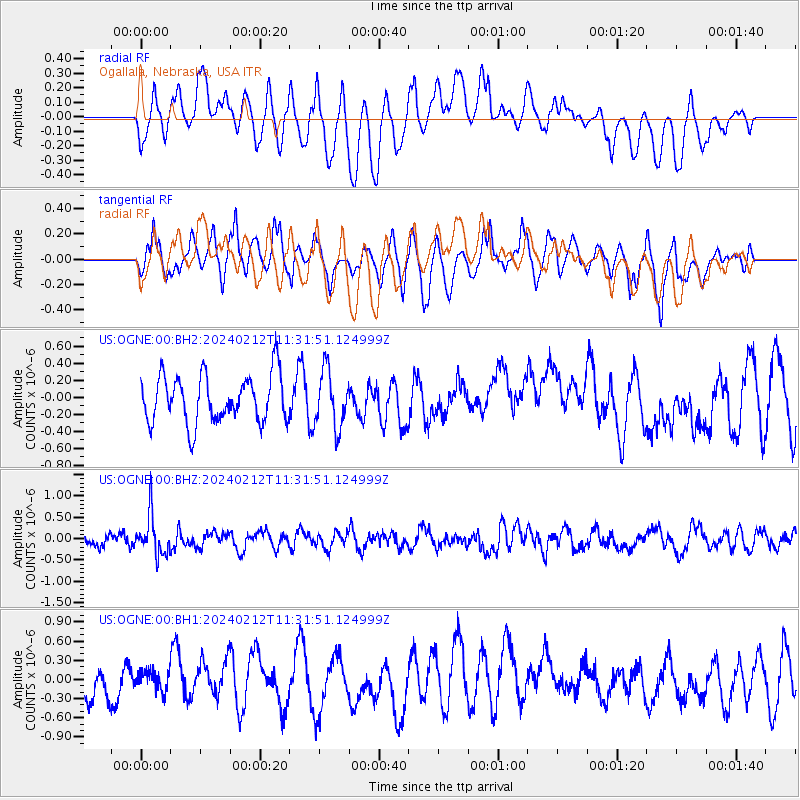
Signal To Noise
| Channel | StoN | STA | LTA |
| US:OGNE:00:BHZ:20240212T11:31:51.124999Z | 4.108503 | 4.6760698E-7 | 1.1381445E-7 |
| US:OGNE:00:BH1:20240212T11:31:51.124999Z | 0.3488551 | 1.6017194E-7 | 4.5913603E-7 |
| US:OGNE:00:BH2:20240212T11:31:51.124999Z | 1.200666 | 3.356667E-7 | 2.795671E-7 |
| Arrivals |
| Ps | |
| PpPs | |
| PsPs/PpSs | |


