You are here: Home > Network List > US - United States National Seismic Network Stations List
> Station MIAR Mount Ida, Arkansas, USA > Earthquake Result Viewer
MIAR Mount Ida, Arkansas, USA - Earthquake Result Viewer
*The percent match for this event was below the threshold and hence no stack was calculated.
| Earthquake location: |
Hokkaido, Japan Region |
| Earthquake latitude/longitude: |
41.5/142.0 |
| Earthquake time(UTC): |
2010/09/13 (256) 05:47:48 GMT |
| Earthquake Depth: |
61 km |
| Earthquake Magnitude: |
5.8 MB, 5.8 MW, 5.8 MW |
| Earthquake Catalog/Contributor: |
WHDF/NEIC |
|
| Network: |
US United States National Seismic Network |
| Station: |
MIAR Mount Ida, Arkansas, USA |
| Lat/Lon: |
34.55 N/93.58 W |
| Elevation: |
207 m |
|
| Distance: |
88.7 deg |
| Az: |
42.917 deg |
| Baz: |
321.704 deg |
| Ray Param: |
$rayparam |
*The percent match for this event was below the threshold and hence was not used in the summary stack. |
|
| Radial Match: |
46.432247 % |
| Radial Bump: |
400 |
| Transverse Match: |
50.009846 % |
| Transverse Bump: |
400 |
| SOD ConfigId: |
319893 |
| Insert Time: |
2011-01-20 08:21:16.290 +0000 |
| GWidth: |
2.5 |
| Max Bumps: |
400 |
| Tol: |
0.001 |
|
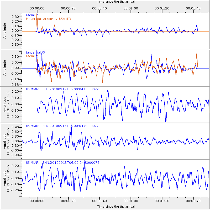
Signal To Noise
| Channel | StoN | STA | LTA |
| US:MIAR: :BHZ:20100913T06:00:04.800007Z | 1.9274215 | 3.482266E-7 | 1.8066966E-7 |
| US:MIAR: :BHN:20100913T06:00:04.800007Z | 1.7840737 | 1.4386144E-7 | 8.063649E-8 |
| US:MIAR: :BHE:20100913T06:00:04.800007Z | 0.92836195 | 8.348947E-8 | 8.993202E-8 |
| Arrivals |
| Ps | |
| PpPs | |
| PsPs/PpSs | |


