You are here: Home > Network List > US - United States National Seismic Network Stations List
> Station WMOK Wichita Mountains, Oklahoma, USA > Earthquake Result Viewer
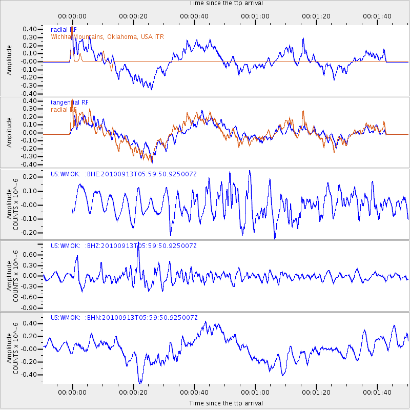
WMOK Wichita Mountains, Oklahoma, USA - Earthquake Result Viewer
*The percent match for this event was below the threshold and hence no stack was calculated.
| Earthquake location: |
Hokkaido, Japan Region |
| Earthquake latitude/longitude: |
41.5/142.0 |
| Earthquake time(UTC): |
2010/09/13 (256) 05:47:48 GMT |
| Earthquake Depth: |
61 km |
| Earthquake Magnitude: |
5.8 MB, 5.8 MW, 5.8 MW |
| Earthquake Catalog/Contributor: |
WHDF/NEIC |
|
| Network: |
US United States National Seismic Network |
| Station: |
WMOK Wichita Mountains, Oklahoma, USA |
| Lat/Lon: |
34.74 N/98.78 W |
| Elevation: |
486 m |
|
| Distance: |
85.9 deg |
| Az: |
46.099 deg |
| Baz: |
318.907 deg |
| Ray Param: |
$rayparam |
*The percent match for this event was below the threshold and hence was not used in the summary stack. |
|
| Radial Match: |
34.32155 % |
| Radial Bump: |
400 |
| Transverse Match: |
35.094543 % |
| Transverse Bump: |
400 |
| SOD ConfigId: |
319893 |
| Insert Time: |
2011-01-20 08:21:21.679 +0000 |
| GWidth: |
2.5 |
| Max Bumps: |
400 |
| Tol: |
0.001 |
|
Signal To Noise
| Channel | StoN | STA | LTA |
| US:WMOK: :BHZ:20100913T05:59:50.925007Z | 4.643729 | 2.737524E-7 | 5.8950977E-8 |
| US:WMOK: :BHN:20100913T05:59:50.925007Z | 0.79591006 | 1.305439E-7 | 1.640184E-7 |
| US:WMOK: :BHE:20100913T05:59:50.925007Z | 1.3049476 | 1.00992885E-7 | 7.739229E-8 |
| Arrivals |
| Ps | |
| PpPs | |
| PsPs/PpSs | |


