You are here: Home > Network List > UW - Pacific Northwest Regional Seismic Network Stations List
> Station IRON Crane, OR, USA > Earthquake Result Viewer
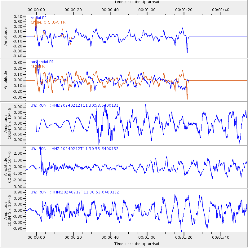
IRON Crane, OR, USA - Earthquake Result Viewer
*The percent match for this event was below the threshold and hence no stack was calculated.
| Earthquake location: |
Volcano Islands, Japan Region |
| Earthquake latitude/longitude: |
22.0/142.7 |
| Earthquake time(UTC): |
2024/02/12 (043) 11:19:36 GMT |
| Earthquake Depth: |
250 km |
| Earthquake Magnitude: |
6.1 mww |
| Earthquake Catalog/Contributor: |
NEIC PDE/us |
|
| Network: |
UW Pacific Northwest Regional Seismic Network |
| Station: |
IRON Crane, OR, USA |
| Lat/Lon: |
43.36 N/118.47 W |
| Elevation: |
1226 m |
|
| Distance: |
81.3 deg |
| Az: |
46.826 deg |
| Baz: |
291.915 deg |
| Ray Param: |
$rayparam |
*The percent match for this event was below the threshold and hence was not used in the summary stack. |
|
| Radial Match: |
69.31615 % |
| Radial Bump: |
400 |
| Transverse Match: |
67.05305 % |
| Transverse Bump: |
400 |
| SOD ConfigId: |
33437571 |
| Insert Time: |
2024-02-26 11:47:51.554 +0000 |
| GWidth: |
2.5 |
| Max Bumps: |
400 |
| Tol: |
0.001 |
|
Signal To Noise
| Channel | StoN | STA | LTA |
| UW:IRON: :HHZ:20240212T11:30:53.640013Z | 2.504756 | 8.711198E-7 | 3.4778628E-7 |
| UW:IRON: :HHN:20240212T11:30:53.640013Z | 0.54301536 | 2.3936144E-7 | 4.408005E-7 |
| UW:IRON: :HHE:20240212T11:30:53.640013Z | 2.5030706 | 5.367828E-7 | 2.1444971E-7 |
| Arrivals |
| Ps | |
| PpPs | |
| PsPs/PpSs | |


