You are here: Home > Network List > US - United States National Seismic Network Stations List
> Station DGMT Dagmar, Montana, USA > Earthquake Result Viewer
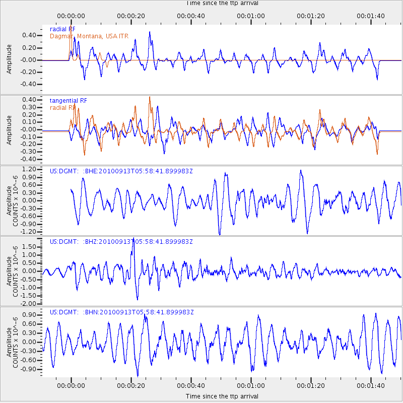
DGMT Dagmar, Montana, USA - Earthquake Result Viewer
*The percent match for this event was below the threshold and hence no stack was calculated.
| Earthquake location: |
Hokkaido, Japan Region |
| Earthquake latitude/longitude: |
41.5/142.0 |
| Earthquake time(UTC): |
2010/09/13 (256) 05:47:48 GMT |
| Earthquake Depth: |
61 km |
| Earthquake Magnitude: |
5.8 MB, 5.8 MW, 5.8 MW |
| Earthquake Catalog/Contributor: |
WHDF/NEIC |
|
| Network: |
US United States National Seismic Network |
| Station: |
DGMT Dagmar, Montana, USA |
| Lat/Lon: |
48.47 N/104.20 W |
| Elevation: |
0.0 m |
|
| Distance: |
73.1 deg |
| Az: |
39.516 deg |
| Baz: |
314.087 deg |
| Ray Param: |
$rayparam |
*The percent match for this event was below the threshold and hence was not used in the summary stack. |
|
| Radial Match: |
69.38617 % |
| Radial Bump: |
390 |
| Transverse Match: |
62.303932 % |
| Transverse Bump: |
400 |
| SOD ConfigId: |
319893 |
| Insert Time: |
2011-01-20 08:23:34.903 +0000 |
| GWidth: |
2.5 |
| Max Bumps: |
400 |
| Tol: |
0.001 |
|
Signal To Noise
| Channel | StoN | STA | LTA |
| US:DGMT: :BHZ:20100913T05:58:41.899983Z | 2.2769141 | 5.043973E-7 | 2.215267E-7 |
| US:DGMT: :BHN:20100913T05:58:41.899983Z | 0.6304546 | 2.154755E-7 | 3.4177796E-7 |
| US:DGMT: :BHE:20100913T05:58:41.899983Z | 1.0925612 | 4.136539E-7 | 3.7860934E-7 |
| Arrivals |
| Ps | |
| PpPs | |
| PsPs/PpSs | |


