You are here: Home > Network List > US - United States National Seismic Network Stations List
> Station EGMT Eagleton, Montana, USA > Earthquake Result Viewer
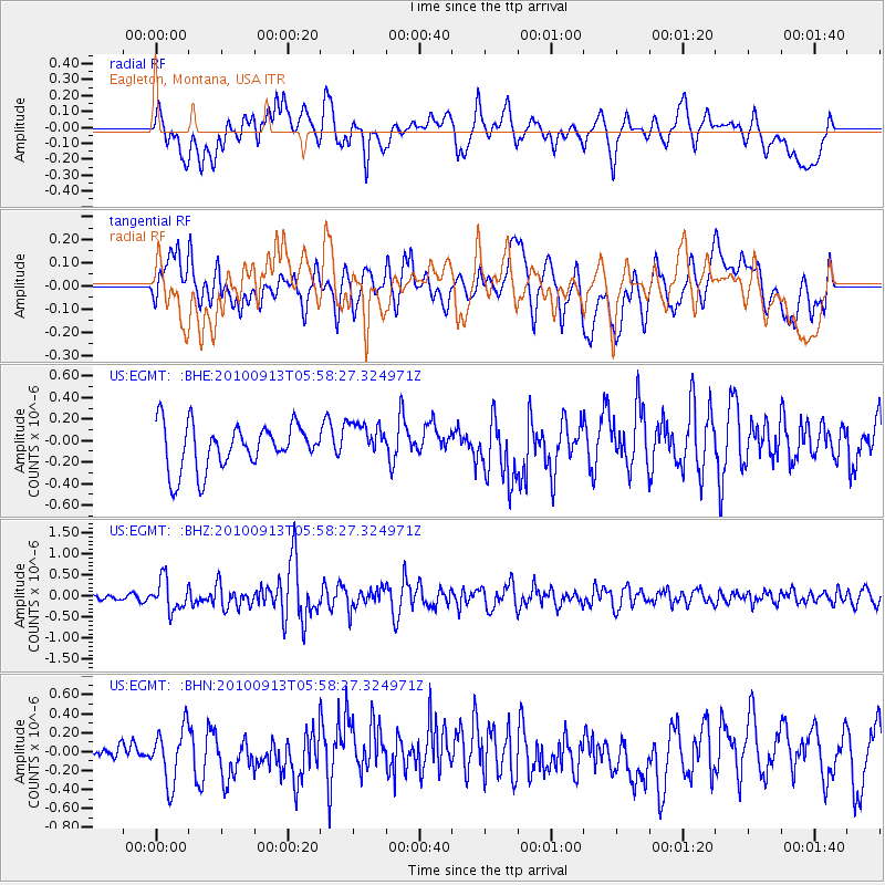
EGMT Eagleton, Montana, USA - Earthquake Result Viewer
*The percent match for this event was below the threshold and hence no stack was calculated.
| Earthquake location: |
Hokkaido, Japan Region |
| Earthquake latitude/longitude: |
41.5/142.0 |
| Earthquake time(UTC): |
2010/09/13 (256) 05:47:48 GMT |
| Earthquake Depth: |
61 km |
| Earthquake Magnitude: |
5.8 MB, 5.8 MW, 5.8 MW |
| Earthquake Catalog/Contributor: |
WHDF/NEIC |
|
| Network: |
US United States National Seismic Network |
| Station: |
EGMT Eagleton, Montana, USA |
| Lat/Lon: |
48.02 N/109.75 W |
| Elevation: |
1055 m |
|
| Distance: |
70.7 deg |
| Az: |
42.502 deg |
| Baz: |
310.88 deg |
| Ray Param: |
$rayparam |
*The percent match for this event was below the threshold and hence was not used in the summary stack. |
|
| Radial Match: |
57.53239 % |
| Radial Bump: |
400 |
| Transverse Match: |
63.45859 % |
| Transverse Bump: |
400 |
| SOD ConfigId: |
319893 |
| Insert Time: |
2011-01-20 08:24:02.196 +0000 |
| GWidth: |
2.5 |
| Max Bumps: |
400 |
| Tol: |
0.001 |
|
Signal To Noise
| Channel | StoN | STA | LTA |
| US:EGMT: :BHZ:20100913T05:58:27.324971Z | 4.0120997 | 3.654209E-7 | 9.107972E-8 |
| US:EGMT: :BHN:20100913T05:58:27.324971Z | 1.6431539 | 2.8989587E-7 | 1.764265E-7 |
| US:EGMT: :BHE:20100913T05:58:27.324971Z | 0.83021635 | 1.7284154E-7 | 2.0818855E-7 |
| Arrivals |
| Ps | |
| PpPs | |
| PsPs/PpSs | |


