You are here: Home > Network List > AZ - ANZA Regional Network Stations List
> Station CRY AZ.CRY > Earthquake Result Viewer
CRY AZ.CRY - Earthquake Result Viewer

| Earthquake location: |
South Of Fiji Islands |
| Earthquake latitude/longitude: |
-26.8/-177.2 |
| Earthquake time(UTC): |
1996/07/23 (205) 03:32:12 GMT |
| Earthquake Depth: |
33 km |
| Earthquake Magnitude: |
5.8 MB, 6.4 MS, 6.5 UNKNOWN, 6.5 MW |
| Earthquake Catalog/Contributor: |
WHDF/NEIC |
|
| Network: |
AZ ANZA Regional Network |
| Station: |
CRY AZ.CRY |
| Lat/Lon: |
33.57 N/116.74 W |
| Elevation: |
1128 m |
|
| Distance: |
83.0 deg |
| Az: |
47.044 deg |
| Baz: |
231.607 deg |
| Ray Param: |
0.046445593 |
| Estimated Moho Depth: |
69.75 km |
| Estimated Crust Vp/Vs: |
2.02 |
| Assumed Crust Vp: |
6.264 km/s |
| Estimated Crust Vs: |
3.097 km/s |
| Estimated Crust Poisson's Ratio: |
0.34 |
|
| Radial Match: |
92.44693 % |
| Radial Bump: |
383 |
| Transverse Match: |
88.349335 % |
| Transverse Bump: |
400 |
| SOD ConfigId: |
6273 |
| Insert Time: |
2010-02-26 18:57:53.307 +0000 |
| GWidth: |
2.5 |
| Max Bumps: |
400 |
| Tol: |
0.001 |
|
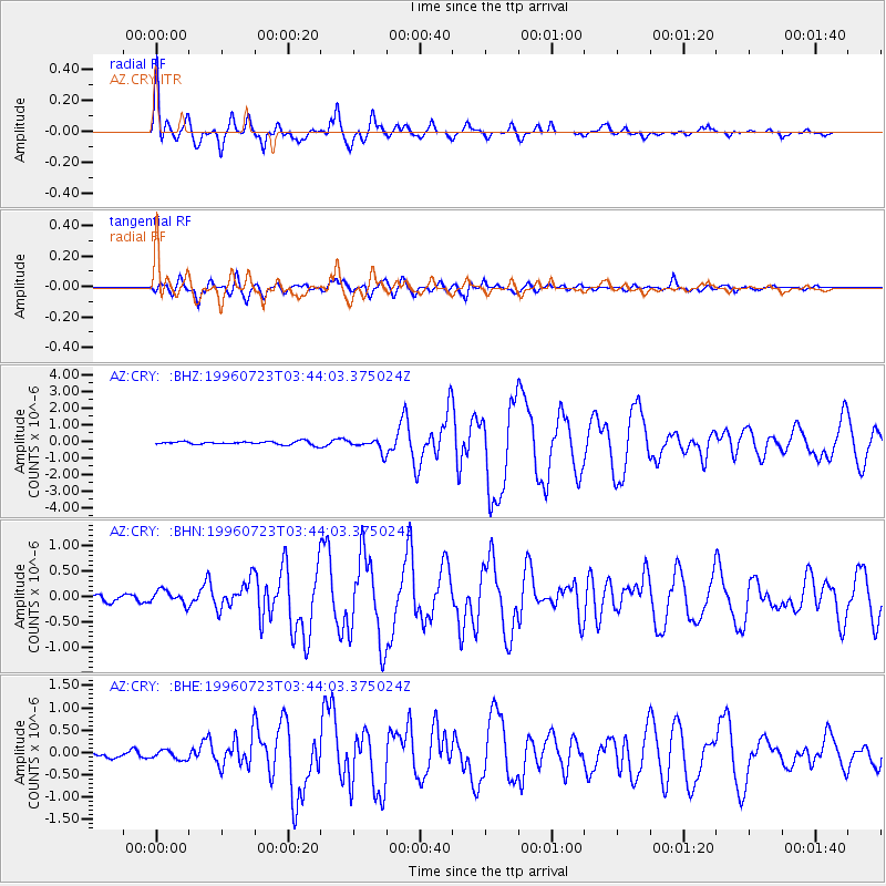
Signal To Noise
| Channel | StoN | STA | LTA |
| AZ:CRY: :BHN:19960723T03:44:03.375024Z | 1.3204539 | 1.4468074E-7 | 1.09568944E-7 |
| AZ:CRY: :BHE:19960723T03:44:03.375024Z | 1.1245358 | 9.9486364E-8 | 8.846884E-8 |
| AZ:CRY: :BHZ:19960723T03:44:03.375024Z | 3.7596416 | 3.77893E-7 | 1.0051304E-7 |
| Arrivals |
| Ps | 12 SECOND |
| PpPs | 33 SECOND |
| PsPs/PpSs | 45 SECOND |


