You are here: Home > Network List > UW - Pacific Northwest Regional Seismic Network Stations List
> Station UMAT Pilot Rock, OR, USA > Earthquake Result Viewer
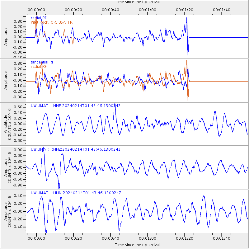
UMAT Pilot Rock, OR, USA - Earthquake Result Viewer
*The percent match for this event was below the threshold and hence no stack was calculated.
| Earthquake location: |
Near Coast Of Central Chile |
| Earthquake latitude/longitude: |
-28.9/-71.5 |
| Earthquake time(UTC): |
2024/02/14 (045) 01:31:41 GMT |
| Earthquake Depth: |
22 km |
| Earthquake Magnitude: |
6.0 mww |
| Earthquake Catalog/Contributor: |
NEIC PDE/us |
|
| Network: |
UW Pacific Northwest Regional Seismic Network |
| Station: |
UMAT Pilot Rock, OR, USA |
| Lat/Lon: |
45.29 N/118.96 W |
| Elevation: |
1318 m |
|
| Distance: |
85.5 deg |
| Az: |
328.569 deg |
| Baz: |
139.636 deg |
| Ray Param: |
$rayparam |
*The percent match for this event was below the threshold and hence was not used in the summary stack. |
|
| Radial Match: |
56.305008 % |
| Radial Bump: |
400 |
| Transverse Match: |
64.22668 % |
| Transverse Bump: |
331 |
| SOD ConfigId: |
33437571 |
| Insert Time: |
2024-02-28 01:57:30.748 +0000 |
| GWidth: |
2.5 |
| Max Bumps: |
400 |
| Tol: |
0.001 |
|
Signal To Noise
| Channel | StoN | STA | LTA |
| UW:UMAT: :HHZ:20240214T01:43:46.130024Z | 3.563907 | 4.7253448E-7 | 1.325889E-7 |
| UW:UMAT: :HHN:20240214T01:43:46.130024Z | 1.2625922 | 2.4995956E-7 | 1.979733E-7 |
| UW:UMAT: :HHE:20240214T01:43:46.130024Z | 0.96023434 | 2.1598748E-7 | 2.2493205E-7 |
| Arrivals |
| Ps | |
| PpPs | |
| PsPs/PpSs | |


