You are here: Home > Network List > CI - Caltech Regional Seismic Network Stations List
> Station MPM Manuel Prospect Mine, California, USA > Earthquake Result Viewer
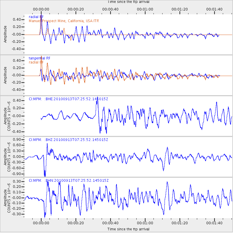
MPM Manuel Prospect Mine, California, USA - Earthquake Result Viewer
*The percent match for this event was below the threshold and hence no stack was calculated.
| Earthquake location: |
Central Peru |
| Earthquake latitude/longitude: |
-14.6/-70.8 |
| Earthquake time(UTC): |
2010/09/13 (256) 07:15:49 GMT |
| Earthquake Depth: |
180 km |
| Earthquake Magnitude: |
5.6 MB, 5.9 MW, 5.8 MW |
| Earthquake Catalog/Contributor: |
WHDF/NEIC |
|
| Network: |
CI Caltech Regional Seismic Network |
| Station: |
MPM Manuel Prospect Mine, California, USA |
| Lat/Lon: |
36.06 N/117.49 W |
| Elevation: |
185 m |
|
| Distance: |
67.0 deg |
| Az: |
320.146 deg |
| Baz: |
130.039 deg |
| Ray Param: |
$rayparam |
*The percent match for this event was below the threshold and hence was not used in the summary stack. |
|
| Radial Match: |
69.56181 % |
| Radial Bump: |
400 |
| Transverse Match: |
66.45002 % |
| Transverse Bump: |
400 |
| SOD ConfigId: |
319893 |
| Insert Time: |
2011-01-20 08:34:07.814 +0000 |
| GWidth: |
2.5 |
| Max Bumps: |
400 |
| Tol: |
0.001 |
|
Signal To Noise
| Channel | StoN | STA | LTA |
| CI:MPM: :BHZ:20100913T07:25:52.145015Z | 5.203166 | 4.285584E-7 | 8.236493E-8 |
| CI:MPM: :BHN:20100913T07:25:52.145015Z | 3.8809953 | 1.7537768E-7 | 4.518884E-8 |
| CI:MPM: :BHE:20100913T07:25:52.145015Z | 4.1801596 | 2.440272E-7 | 5.837748E-8 |
| Arrivals |
| Ps | |
| PpPs | |
| PsPs/PpSs | |


