CRY AZ.CRY - Earthquake Result Viewer
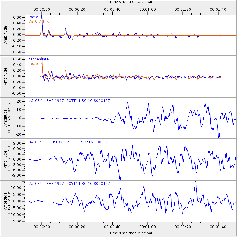
Earthquake location: Near East Coast Of Kamchatka
Earthquake latitude/longitude: 54.8/162.0
Earthquake time(UTC): 1997/12/05 (339) 11:26:54 GMT
Earthquake Depth: 33 km
Earthquake Magnitude: 6.3 MB, 7.6 MS, 7.9 UNKNOWN, 7.3 ME
Earthquake Catalog/Contributor: WHDF/NEIC
Network: AZ ANZA Regional Network
Station: CRY AZ.CRY
Lat/Lon: 33.57 N/116.74 W
Elevation: 1128 m
Distance: 58.5 deg
Az: 75.433 deg
Baz: 317.895 deg
Ray Param: 0.0627494
Estimated Moho Depth: 32.75 km
Estimated Crust Vp/Vs: 1.75
Assumed Crust Vp: 6.264 km/s
Estimated Crust Vs: 3.589 km/s
Estimated Crust Poisson's Ratio: 0.26
Radial Match: 96.200096 %
Radial Bump: 285
Transverse Match: 86.246185 %
Transverse Bump: 400
SOD ConfigId: 9875
Insert Time: 2010-02-26 18:57:59.177 +0000
GWidth: 2.5
Max Bumps: 400
Tol: 0.001

Signal To Noise

ChannelStoNSTALTA
AZ:CRY: :BHN:19971205T11:36:16.800012Z0.844520871.6132326E-71.9102342E-7
AZ:CRY: :BHE:19971205T11:36:16.800012Z0.435118141.6332176E-73.7535037E-7
AZ:CRY: :BHZ:19971205T11:36:16.800012Z2.83032321.2148856E-64.2923918E-7
Arrivals
Ps4.1 SECOND
PpPs14 SECOND
PsPs/PpSs18 SECOND