You are here: Home > Network List > UW - Pacific Northwest Regional Seismic Network Stations List
> Station HOOD Mt Hood Meadows, OR CREST BB SMO > Earthquake Result Viewer
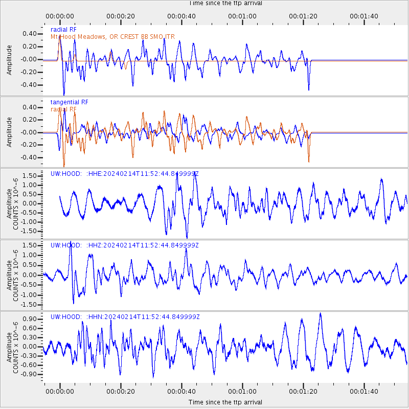
HOOD Mt Hood Meadows, OR CREST BB SMO - Earthquake Result Viewer
*The percent match for this event was below the threshold and hence no stack was calculated.
| Earthquake location: |
W. Caroline Islands, Micronesia |
| Earthquake latitude/longitude: |
11.0/138.6 |
| Earthquake time(UTC): |
2024/02/14 (045) 11:40:21 GMT |
| Earthquake Depth: |
10 km |
| Earthquake Magnitude: |
6.0 mww |
| Earthquake Catalog/Contributor: |
NEIC PDE/us |
|
| Network: |
UW Pacific Northwest Regional Seismic Network |
| Station: |
HOOD Mt Hood Meadows, OR CREST BB SMO |
| Lat/Lon: |
45.32 N/121.65 W |
| Elevation: |
1520 m |
|
| Distance: |
89.0 deg |
| Az: |
44.063 deg |
| Baz: |
284.562 deg |
| Ray Param: |
$rayparam |
*The percent match for this event was below the threshold and hence was not used in the summary stack. |
|
| Radial Match: |
57.800613 % |
| Radial Bump: |
400 |
| Transverse Match: |
76.28413 % |
| Transverse Bump: |
400 |
| SOD ConfigId: |
33437571 |
| Insert Time: |
2024-02-28 12:01:21.330 +0000 |
| GWidth: |
2.5 |
| Max Bumps: |
400 |
| Tol: |
0.001 |
|
Signal To Noise
| Channel | StoN | STA | LTA |
| UW:HOOD: :HHZ:20240214T11:52:44.849999Z | 4.020784 | 6.7242945E-7 | 1.672384E-7 |
| UW:HOOD: :HHN:20240214T11:52:44.849999Z | 1.0703833 | 1.9278707E-7 | 1.801103E-7 |
| UW:HOOD: :HHE:20240214T11:52:44.849999Z | 2.003459 | 7.334266E-7 | 3.6608014E-7 |
| Arrivals |
| Ps | |
| PpPs | |
| PsPs/PpSs | |


