You are here: Home > Network List > TA - USArray Transportable Network (new EarthScope stations) Stations List
> Station 230A Sterling City, TX, USA > Earthquake Result Viewer
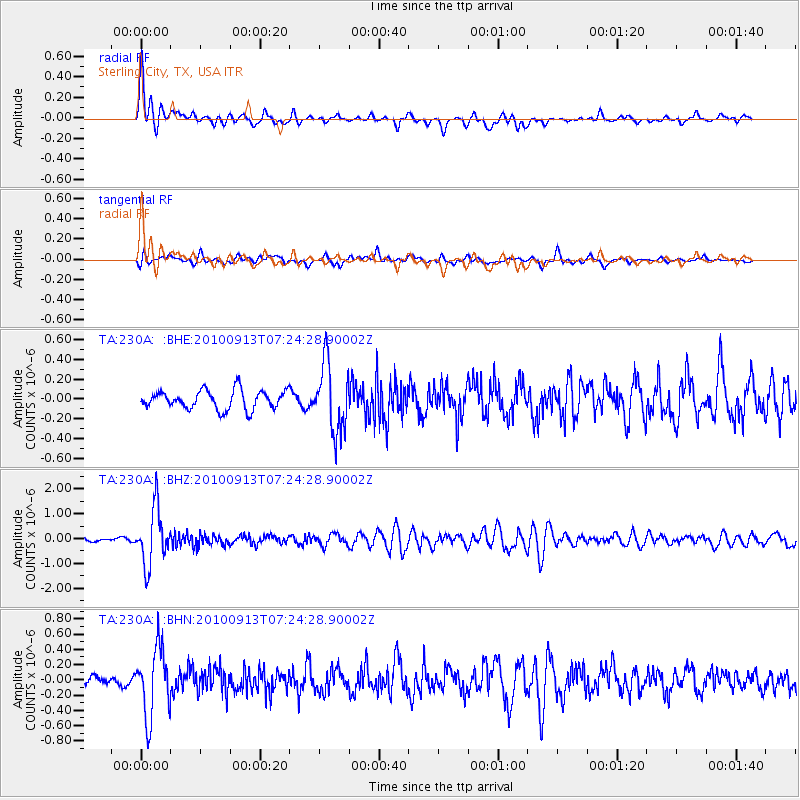
230A Sterling City, TX, USA - Earthquake Result Viewer
*The percent match for this event was below the threshold and hence no stack was calculated.
| Earthquake location: |
Central Peru |
| Earthquake latitude/longitude: |
-14.6/-70.8 |
| Earthquake time(UTC): |
2010/09/13 (256) 07:15:49 GMT |
| Earthquake Depth: |
180 km |
| Earthquake Magnitude: |
5.6 MB, 5.9 MW, 5.8 MW |
| Earthquake Catalog/Contributor: |
WHDF/NEIC |
|
| Network: |
TA USArray Transportable Network (new EarthScope stations) |
| Station: |
230A Sterling City, TX, USA |
| Lat/Lon: |
31.89 N/101.11 W |
| Elevation: |
742 m |
|
| Distance: |
54.6 deg |
| Az: |
328.201 deg |
| Baz: |
143.155 deg |
| Ray Param: |
$rayparam |
*The percent match for this event was below the threshold and hence was not used in the summary stack. |
|
| Radial Match: |
79.50718 % |
| Radial Bump: |
400 |
| Transverse Match: |
66.62486 % |
| Transverse Bump: |
400 |
| SOD ConfigId: |
319893 |
| Insert Time: |
2011-01-20 08:47:52.397 +0000 |
| GWidth: |
2.5 |
| Max Bumps: |
400 |
| Tol: |
0.001 |
|
Signal To Noise
| Channel | StoN | STA | LTA |
| TA:230A: :BHZ:20100913T07:24:28.90002Z | 10.4232025 | 1.1253716E-6 | 1.0796792E-7 |
| TA:230A: :BHN:20100913T07:24:28.90002Z | 5.8709702 | 4.4885755E-7 | 7.645373E-8 |
| TA:230A: :BHE:20100913T07:24:28.90002Z | 3.6409342 | 3.442547E-7 | 9.45512E-8 |
| Arrivals |
| Ps | |
| PpPs | |
| PsPs/PpSs | |


