You are here: Home > Network List > AK - Alaska Regional Network Stations List
> Station MDM Murphy Dome > Earthquake Result Viewer
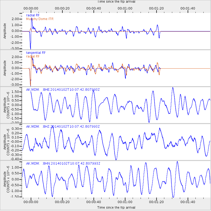
MDM Murphy Dome - Earthquake Result Viewer
*The percent match for this event was below the threshold and hence no stack was calculated.
| Earthquake location: |
Philippine Islands Region |
| Earthquake latitude/longitude: |
10.4/126.5 |
| Earthquake time(UTC): |
2014/01/02 (002) 09:56:17 GMT |
| Earthquake Depth: |
60 km |
| Earthquake Magnitude: |
5.0 mb |
| Earthquake Catalog/Contributor: |
ISC/ISC |
|
| Network: |
AK Alaska Regional Network |
| Station: |
MDM Murphy Dome |
| Lat/Lon: |
64.96 N/148.23 W |
| Elevation: |
634 m |
|
| Distance: |
78.7 deg |
| Az: |
25.631 deg |
| Baz: |
270.2 deg |
| Ray Param: |
$rayparam |
*The percent match for this event was below the threshold and hence was not used in the summary stack. |
|
| Radial Match: |
44.67309 % |
| Radial Bump: |
400 |
| Transverse Match: |
69.67318 % |
| Transverse Bump: |
400 |
| SOD ConfigId: |
3382691 |
| Insert Time: |
2019-04-09 20:33:15.339 +0000 |
| GWidth: |
2.5 |
| Max Bumps: |
400 |
| Tol: |
0.001 |
|
Signal To Noise
| Channel | StoN | STA | LTA |
| AK:MDM: :BHZ:20140102T10:07:42.807993Z | 0.6340871 | 2.1519868E-7 | 3.393835E-7 |
| AK:MDM: :BHN:20140102T10:07:42.807993Z | 0.3242663 | 3.1185735E-7 | 9.617322E-7 |
| AK:MDM: :BHE:20140102T10:07:42.807993Z | 1.3461434 | 1.0207183E-6 | 7.582538E-7 |
| Arrivals |
| Ps | |
| PpPs | |
| PsPs/PpSs | |


