You are here: Home > Network List > IU - Global Seismograph Network (GSN - IRIS/USGS) Stations List
> Station JOHN Johnston Island, USA > Earthquake Result Viewer
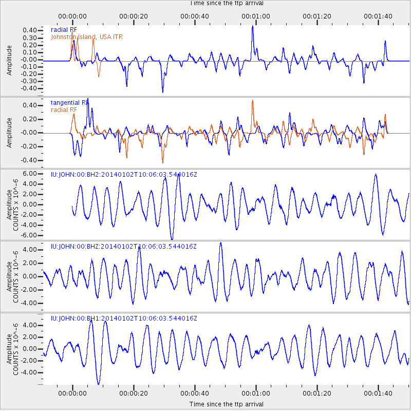
JOHN Johnston Island, USA - Earthquake Result Viewer
*The percent match for this event was below the threshold and hence no stack was calculated.
| Earthquake location: |
Philippine Islands Region |
| Earthquake latitude/longitude: |
10.4/126.5 |
| Earthquake time(UTC): |
2014/01/02 (002) 09:56:17 GMT |
| Earthquake Depth: |
60 km |
| Earthquake Magnitude: |
5.0 mb |
| Earthquake Catalog/Contributor: |
ISC/ISC |
|
| Network: |
IU Global Seismograph Network (GSN - IRIS/USGS) |
| Station: |
JOHN Johnston Island, USA |
| Lat/Lon: |
16.73 N/169.53 W |
| Elevation: |
2.0 m |
|
| Distance: |
62.3 deg |
| Az: |
76.52 deg |
| Baz: |
273.106 deg |
| Ray Param: |
$rayparam |
*The percent match for this event was below the threshold and hence was not used in the summary stack. |
|
| Radial Match: |
41.343613 % |
| Radial Bump: |
338 |
| Transverse Match: |
50.585335 % |
| Transverse Bump: |
400 |
| SOD ConfigId: |
3382691 |
| Insert Time: |
2019-04-09 20:34:26.487 +0000 |
| GWidth: |
2.5 |
| Max Bumps: |
400 |
| Tol: |
0.001 |
|
Signal To Noise
| Channel | StoN | STA | LTA |
| IU:JOHN:00:BHZ:20140102T10:06:03.544016Z | 0.66938597 | 9.711176E-7 | 1.4507589E-6 |
| IU:JOHN:00:BH1:20140102T10:06:03.544016Z | 0.53119296 | 1.4121688E-6 | 2.6584858E-6 |
| IU:JOHN:00:BH2:20140102T10:06:03.544016Z | 1.9025599 | 4.3668633E-6 | 2.2952565E-6 |
| Arrivals |
| Ps | |
| PpPs | |
| PsPs/PpSs | |


