You are here: Home > Network List > US - United States National Seismic Network Stations List
> Station MSO Missoula, Montana, USA > Earthquake Result Viewer
MSO Missoula, Montana, USA - Earthquake Result Viewer
*The percent match for this event was below the threshold and hence no stack was calculated.
| Earthquake location: |
Southern East Pacific Rise |
| Earthquake latitude/longitude: |
-35.1/-110.8 |
| Earthquake time(UTC): |
2024/02/23 (054) 01:51:12 GMT |
| Earthquake Depth: |
2.0 km |
| Earthquake Magnitude: |
6.3 Mww |
| Earthquake Catalog/Contributor: |
NEIC PDE/us |
|
| Network: |
US United States National Seismic Network |
| Station: |
MSO Missoula, Montana, USA |
| Lat/Lon: |
46.83 N/113.94 W |
| Elevation: |
1264 m |
|
| Distance: |
81.6 deg |
| Az: |
357.811 deg |
| Baz: |
177.387 deg |
| Ray Param: |
$rayparam |
*The percent match for this event was below the threshold and hence was not used in the summary stack. |
|
| Radial Match: |
74.85765 % |
| Radial Bump: |
383 |
| Transverse Match: |
62.677864 % |
| Transverse Bump: |
400 |
| SOD ConfigId: |
33437571 |
| Insert Time: |
2024-03-08 02:15:42.342 +0000 |
| GWidth: |
2.5 |
| Max Bumps: |
400 |
| Tol: |
0.001 |
|
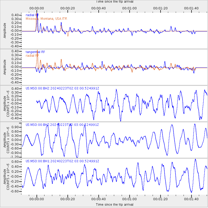
Signal To Noise
| Channel | StoN | STA | LTA |
| US:MSO:00:BHZ:20240223T02:03:00.524991Z | 2.1242456 | 5.9342113E-7 | 2.793562E-7 |
| US:MSO:00:BH1:20240223T02:03:00.524991Z | 1.4142199 | 2.5713476E-7 | 1.8182091E-7 |
| US:MSO:00:BH2:20240223T02:03:00.524991Z | 1.3133717 | 1.7162554E-7 | 1.3067553E-7 |
| Arrivals |
| Ps | |
| PpPs | |
| PsPs/PpSs | |


