You are here: Home > Network List > TA - USArray Transportable Network (new EarthScope stations) Stations List
> Station M31A Lambtecht Ranch, Loup City, NE, USA > Earthquake Result Viewer
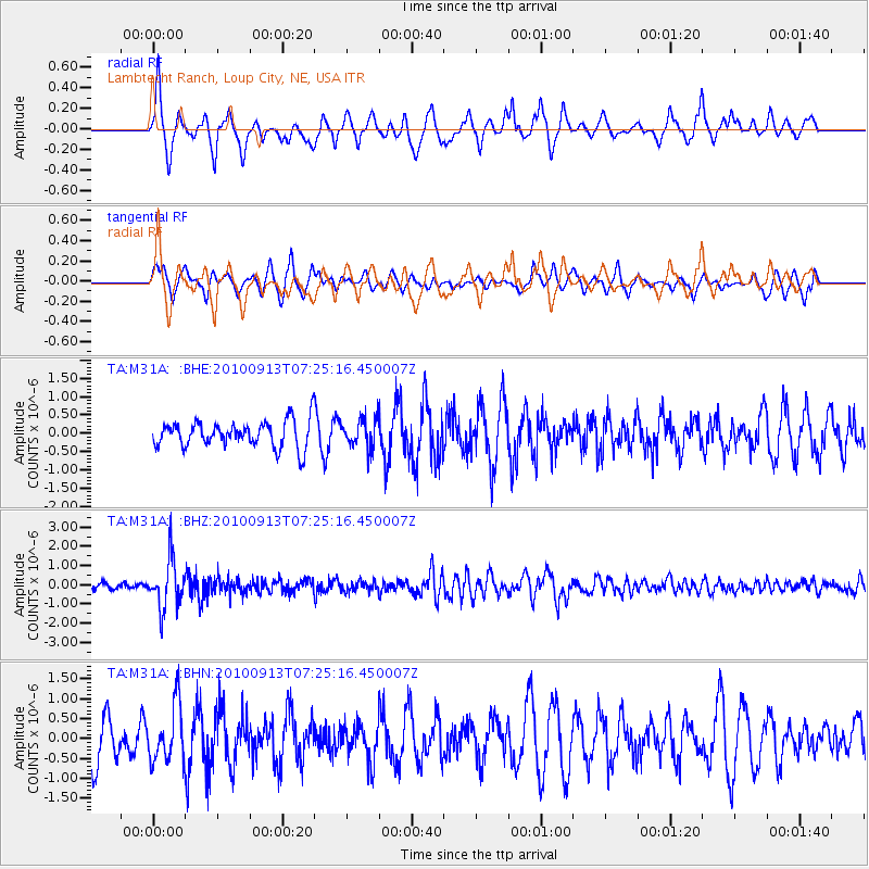
M31A Lambtecht Ranch, Loup City, NE, USA - Earthquake Result Viewer
*The percent match for this event was below the threshold and hence no stack was calculated.
| Earthquake location: |
Central Peru |
| Earthquake latitude/longitude: |
-14.6/-70.8 |
| Earthquake time(UTC): |
2010/09/13 (256) 07:15:49 GMT |
| Earthquake Depth: |
180 km |
| Earthquake Magnitude: |
5.6 MB, 5.9 MW, 5.8 MW |
| Earthquake Catalog/Contributor: |
WHDF/NEIC |
|
| Network: |
TA USArray Transportable Network (new EarthScope stations) |
| Station: |
M31A Lambtecht Ranch, Loup City, NE, USA |
| Lat/Lon: |
41.34 N/98.98 W |
| Elevation: |
699 m |
|
| Distance: |
61.5 deg |
| Az: |
336.113 deg |
| Baz: |
148.626 deg |
| Ray Param: |
$rayparam |
*The percent match for this event was below the threshold and hence was not used in the summary stack. |
|
| Radial Match: |
69.91486 % |
| Radial Bump: |
343 |
| Transverse Match: |
56.03177 % |
| Transverse Bump: |
378 |
| SOD ConfigId: |
319893 |
| Insert Time: |
2011-01-20 08:56:23.037 +0000 |
| GWidth: |
2.5 |
| Max Bumps: |
400 |
| Tol: |
0.001 |
|
Signal To Noise
| Channel | StoN | STA | LTA |
| TA:M31A: :BHZ:20100913T07:25:16.450007Z | 9.402484 | 1.2726713E-6 | 1.353548E-7 |
| TA:M31A: :BHN:20100913T07:25:16.450007Z | 1.5206745 | 7.131241E-7 | 4.689525E-7 |
| TA:M31A: :BHE:20100913T07:25:16.450007Z | 1.0601499 | 3.8374847E-7 | 3.6197568E-7 |
| Arrivals |
| Ps | |
| PpPs | |
| PsPs/PpSs | |


