You are here: Home > Network List > TA - USArray Transportable Network (new EarthScope stations) Stations List
> Station J04D Umpqua National Forest, Toketee, OR, USA > Earthquake Result Viewer
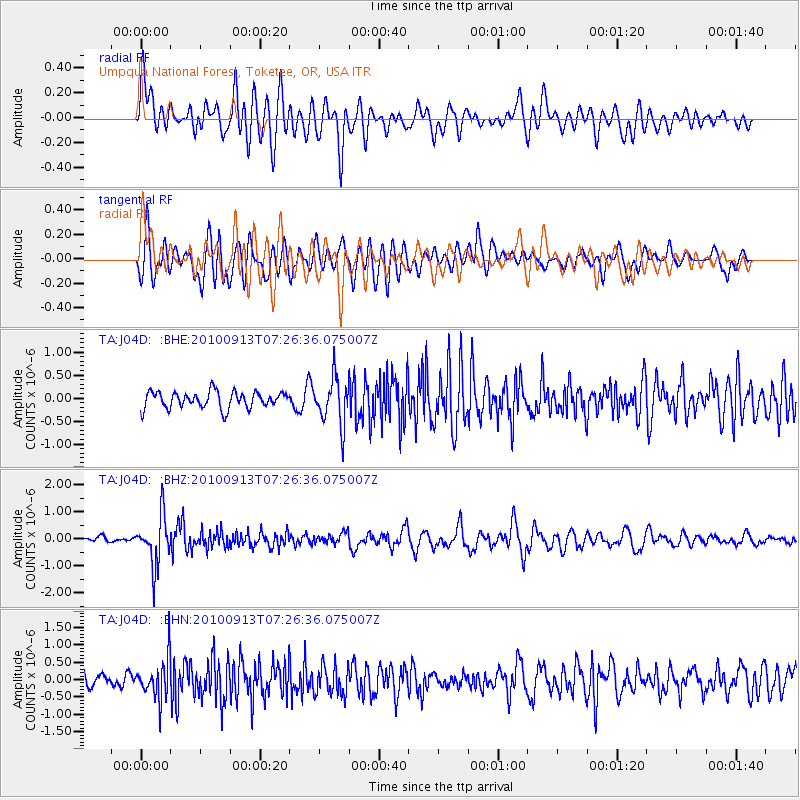
J04D Umpqua National Forest, Toketee, OR, USA - Earthquake Result Viewer
*The percent match for this event was below the threshold and hence no stack was calculated.
| Earthquake location: |
Central Peru |
| Earthquake latitude/longitude: |
-14.6/-70.8 |
| Earthquake time(UTC): |
2010/09/13 (256) 07:15:49 GMT |
| Earthquake Depth: |
180 km |
| Earthquake Magnitude: |
5.6 MB, 5.9 MW, 5.8 MW |
| Earthquake Catalog/Contributor: |
WHDF/NEIC |
|
| Network: |
TA USArray Transportable Network (new EarthScope stations) |
| Station: |
J04D Umpqua National Forest, Toketee, OR, USA |
| Lat/Lon: |
43.24 N/122.11 W |
| Elevation: |
1948 m |
|
| Distance: |
74.3 deg |
| Az: |
323.648 deg |
| Baz: |
128.26 deg |
| Ray Param: |
$rayparam |
*The percent match for this event was below the threshold and hence was not used in the summary stack. |
|
| Radial Match: |
64.94059 % |
| Radial Bump: |
400 |
| Transverse Match: |
62.48999 % |
| Transverse Bump: |
400 |
| SOD ConfigId: |
319893 |
| Insert Time: |
2011-01-20 08:57:36.955 +0000 |
| GWidth: |
2.5 |
| Max Bumps: |
400 |
| Tol: |
0.001 |
|
Signal To Noise
| Channel | StoN | STA | LTA |
| TA:J04D: :BHZ:20100913T07:26:36.075007Z | 8.470967 | 9.1320413E-7 | 1.07804E-7 |
| TA:J04D: :BHN:20100913T07:26:36.075007Z | 2.2480147 | 5.719232E-7 | 2.5441256E-7 |
| TA:J04D: :BHE:20100913T07:26:36.075007Z | 2.8339112 | 5.0613653E-7 | 1.786E-7 |
| Arrivals |
| Ps | |
| PpPs | |
| PsPs/PpSs | |


