You are here: Home > Network List > TA - USArray Transportable Network (new EarthScope stations) Stations List
> Station J05D Fort Rock, OR, USA > Earthquake Result Viewer
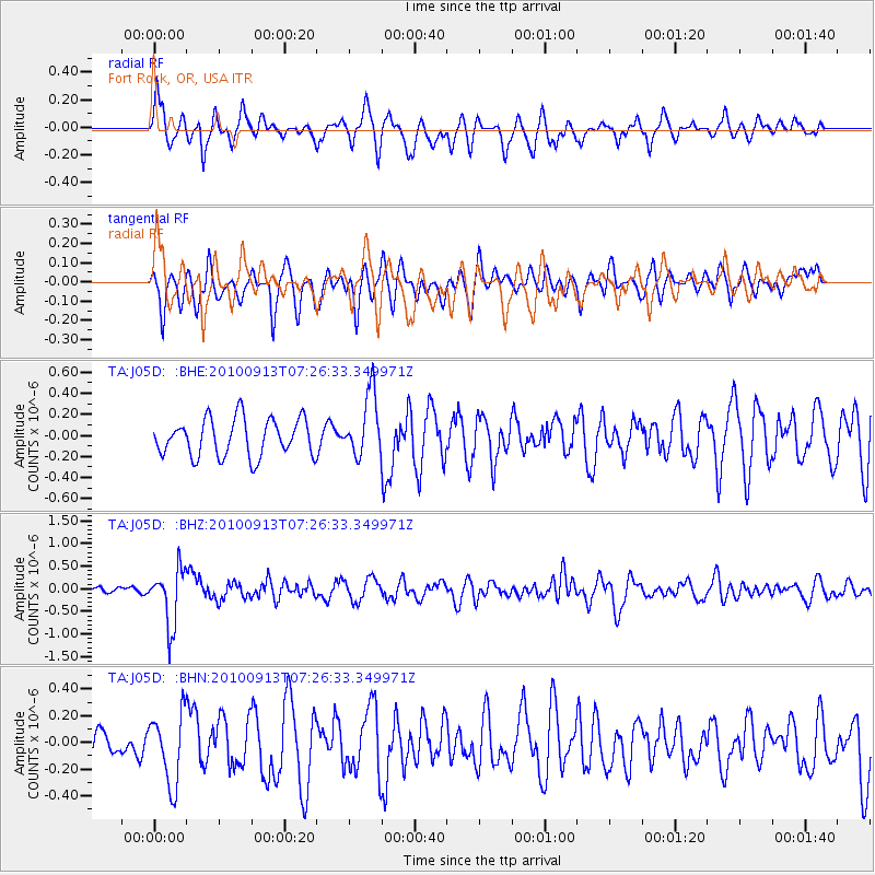
J05D Fort Rock, OR, USA - Earthquake Result Viewer
*The percent match for this event was below the threshold and hence no stack was calculated.
| Earthquake location: |
Central Peru |
| Earthquake latitude/longitude: |
-14.6/-70.8 |
| Earthquake time(UTC): |
2010/09/13 (256) 07:15:49 GMT |
| Earthquake Depth: |
180 km |
| Earthquake Magnitude: |
5.6 MB, 5.9 MW, 5.8 MW |
| Earthquake Catalog/Contributor: |
WHDF/NEIC |
|
| Network: |
TA USArray Transportable Network (new EarthScope stations) |
| Station: |
J05D Fort Rock, OR, USA |
| Lat/Lon: |
43.28 N/121.23 W |
| Elevation: |
1541 m |
|
| Distance: |
73.8 deg |
| Az: |
324.099 deg |
| Baz: |
128.981 deg |
| Ray Param: |
$rayparam |
*The percent match for this event was below the threshold and hence was not used in the summary stack. |
|
| Radial Match: |
59.724995 % |
| Radial Bump: |
400 |
| Transverse Match: |
57.475506 % |
| Transverse Bump: |
400 |
| SOD ConfigId: |
319893 |
| Insert Time: |
2011-01-20 08:58:01.460 +0000 |
| GWidth: |
2.5 |
| Max Bumps: |
400 |
| Tol: |
0.001 |
|
Signal To Noise
| Channel | StoN | STA | LTA |
| TA:J05D: :BHZ:20100913T07:26:33.349971Z | 8.378412 | 6.18458E-7 | 7.381566E-8 |
| TA:J05D: :BHN:20100913T07:26:33.349971Z | 2.2410648 | 2.626759E-7 | 1.1721031E-7 |
| TA:J05D: :BHE:20100913T07:26:33.349971Z | 1.7014568 | 3.0123186E-7 | 1.770435E-7 |
| Arrivals |
| Ps | |
| PpPs | |
| PsPs/PpSs | |


